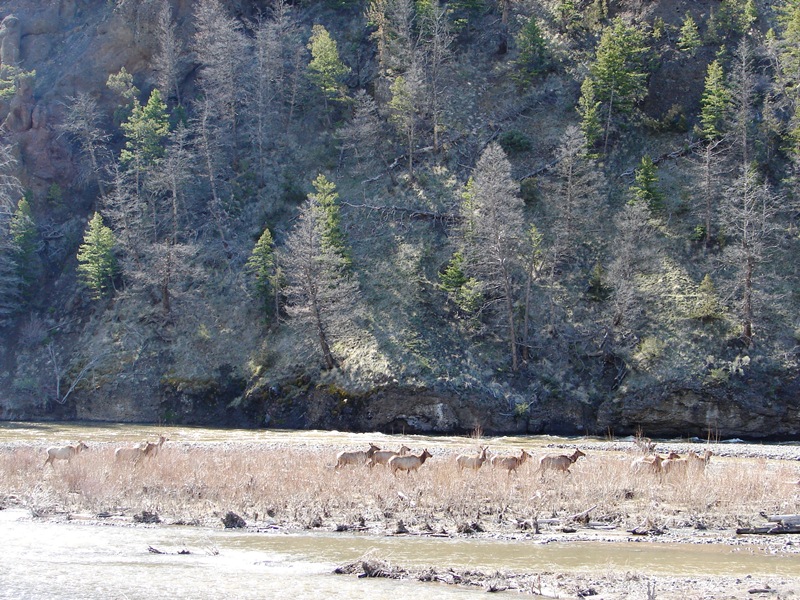
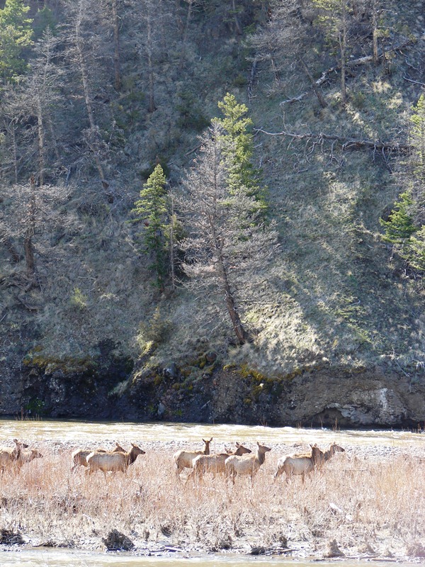
Elk in Shoshone National Forest.
Tom and I spent a relaxing night in Cody and woke up the next morning feeling refreshed and somewhat anxious to see the bear, buffalo, and other wildlife they say roam free in Yellowstone National Park.
Yellowstone was our primary destination, and we decided to make historical Cody our home base because of its proximity to the park. The old western town lies nestled in the shadow of mountains about an hour’s drive from Yellowstone’s East Entrance.
The pungent scent of sage drifts down on a breeze that’s mountain born. We don’t know much of city life or where they seek God there. But we do know in Wyoming that we find Him everywhere. —Author unknown, This God-Forsaken Land
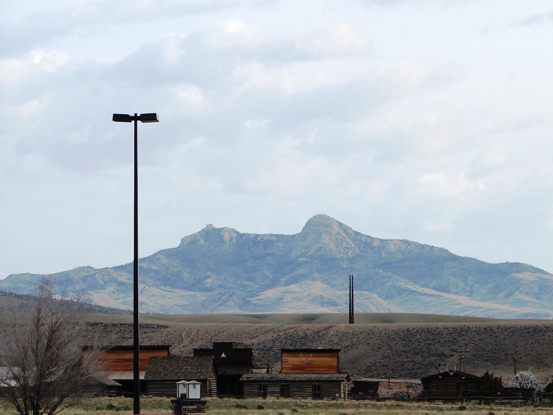
Scene from our hotel parking lot early the next morning—Old Trail Town, the fully-restored, kickass frontier town we didn’t have a chance to visit was across the street from out hotel. That’s Heart Mountain in the distance.
. . . Road Trip thru Wyoming . . .
May 15-16-17, 2011
Day Two: Cody to Yellowstone / Trek to E Entrance
We left Cody for Yellowstone bright and early to ensure we would have plenty of time to take in as much as we could.
This was the plan
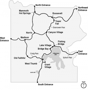
There are five entrances into the park: North, Northeast, East, South, and West.
From Cody we would take the East Entrance into the park to Fishing Bridge . . . then follow the road southwest around Yellowstone Lake past Bridge Bay and West Thumb to Old Faithful . . . continue in a circle to Madison, Norris Junction, Canyon Village, and Fishing Bridge . . . then out the East Entrance back to Cody.
On the next day, we would take the East Entrance in and go the other way . . . up past Fishing Bridge towards Canyon Village . . . continue in a circle to Roosevelt, Mammoth Hot Springs, and Norris Junction . . . back to Canyon Village and Fishing Bridge . . . and out the East Entrance back to Cody.
Calculating the mileage (including round trips to-and-from Cody) and allowing time to stop for food, photos, and potty breaks, we figured it would take two full days to see everything.
It’s a good thing we had that early start. Things did not go quite as planned.
Monday, May 16, 2011 . . . We took the North Fork Highway (US 14-16-20) west out of Cody . . . past the Buffalo Bill Cody Reservoir and Dam . . . through Wapiti Valley and the Shoshone National Forest . . . to the East Entrance of Yellowstone.
When that didn’t work out, we drove back to Cody and tried an alternate route.
Travel time (Route 1: Cody to East Entrance to Cody, not including stops for photos):104 miles, 1 hour 53 minutes
Here’s what happened . . .
The North Fork Highway (US 14-16-20) west is the only road from Cody to Yellowstone’s East Entrance. There are no side roads, no shortcuts, no alternate routes.
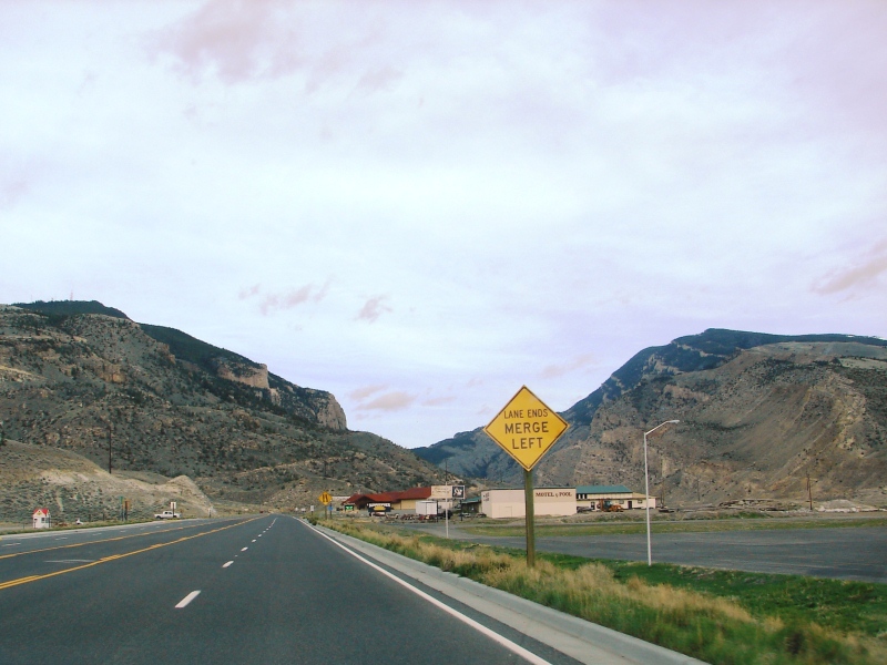
Westward ho . . . on the North Fork Highway, leaving Cody and approaching Shoshone Canyon.
The highway follows the Shoshone River through Shoshone Canyon . . . past the Buffalo Bill Reservoir and Dam . . . through lush Wapiti Valley . . . and into the heart of the Shoshone National Forest where the deer and the antelope play. Elk, moose, bighorn sheep, black bear, and the highest concentration of grizzlies in the continental USA are said to inhabit the area.
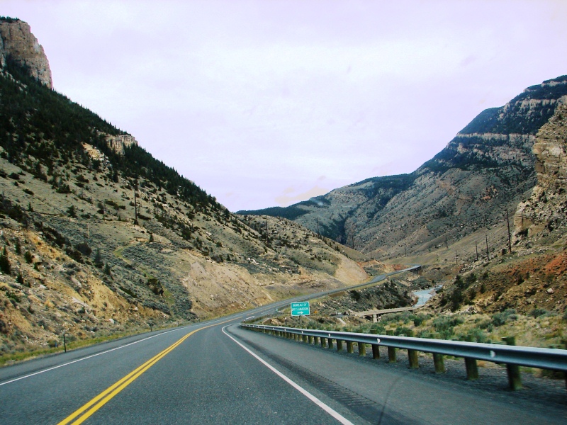
Shoshone Canyon with Cedar Mountain [on left] and Rattlesnake Mountain [on right].
Shoshone Canyon is rugged and craggy. Carved from volcanic rock by the Shoshone River, it has Cedar Mountain on its south side and Rattlesnake Mountain, a massive peak with a summit over 9,000 feet high, to the north. The highway follows the river right through it.
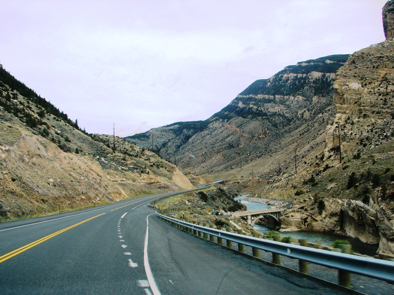
Rattlesnake Mountain is huge and impressive. It rises over 3,300 feet above Shoshone River. For perspective,
the bridge over the river in this photo is a two-lane highway that looks tiny by comparison.
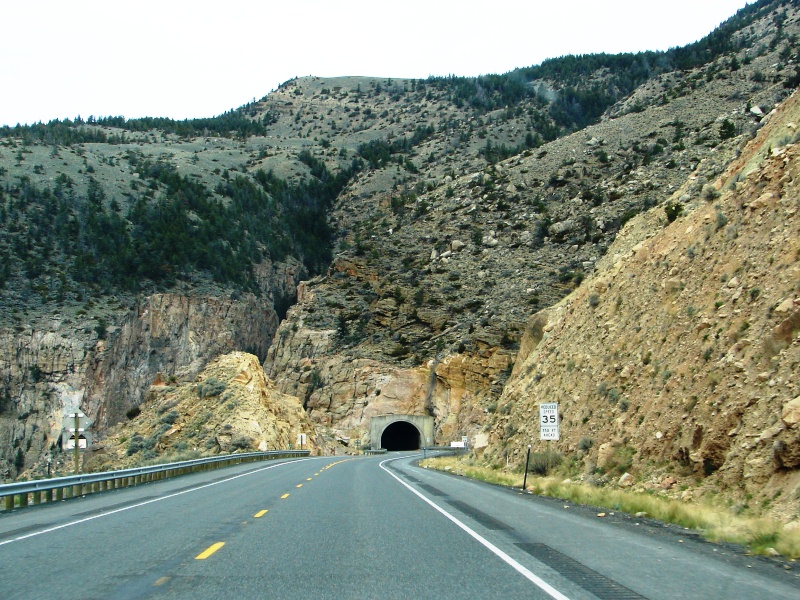
Approaching the first of three tunnels through Rattlesnake Mountain.
About six miles west of Cody, three tunnels cut right through Rattlesnake Mountain’s towering mountain rock.
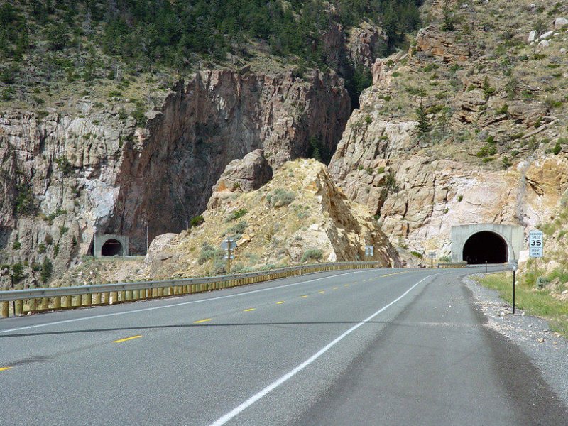
First and third tunnels are visible in this photo. The second tunnel is very short and between the two. (Photo: City-Data)
The first two tunnels are short . . . you’re in-and-out in a flash. The third tunnel is 3,200 feet long, has overhead lights in its domed rock ceiling, and seems to go on forever.
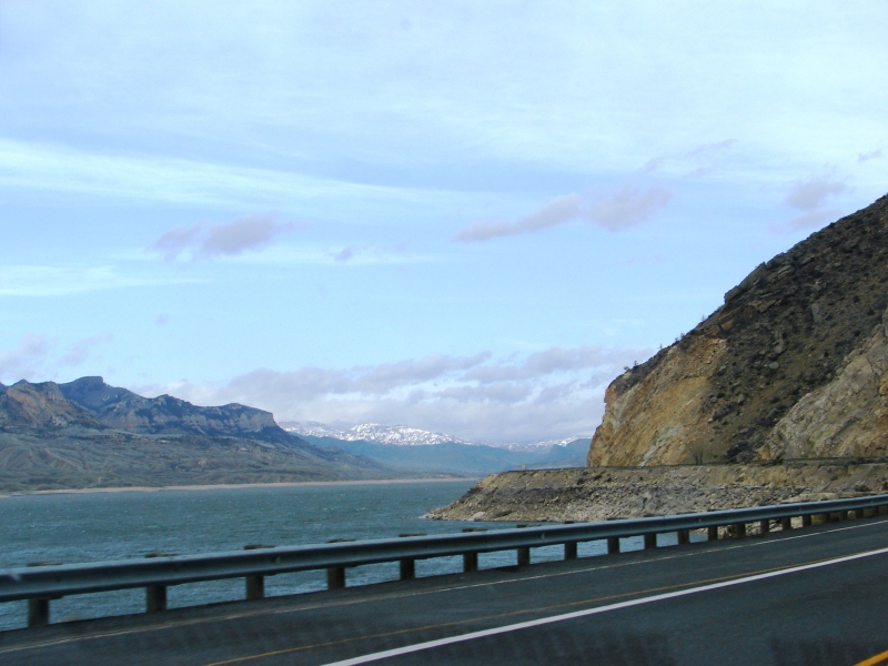
Buffalo Bill Reservoir, Sheep Mountain, and the snow-capped Absaroka Range beyond. The road ahead hugs the mountain and follows the edge of the reservoir.
What we saw was unexpected and breathtaking. The deep green-blue color of the water was a stunning contrast to the stark mountain landscape. And there they were off in the distance . . . the purple mountains majesty—the ones they write songs about.
Cody Way
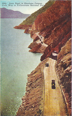
The road from Cody to Yellowstone was once called Cody Way. Theodore Roosevelt described the route as “50 miles of the most scenic land in America.” From an old postcard, you can get a good idea of how the road alongside Buffalo Bill Reservoir looked way back when.
Buffalo Bill Reservoir and Dam
We could not resist stopping.
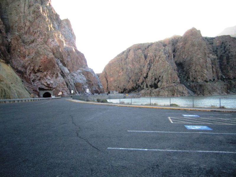
Parking lot for the Buffalo Bill Reservoir and Dam. That’s the third tunnel coming out of Rattlesnake Mountain.
Water for the Buffalo Bill Reservoir comes from the Shoshone River. In the west, the river is split in two by Sheep Mountain. The North Fork of the river starts in the Absaroka Range near the East Entrance of Yellowstone, while the South Fork originates at the southern end of the Absaroka Range. Both forks spill into the reservoir, and the Buffalo Bill Dam blocks the water before it enters Shoshone Canyon.
The reservoir is spectacular.
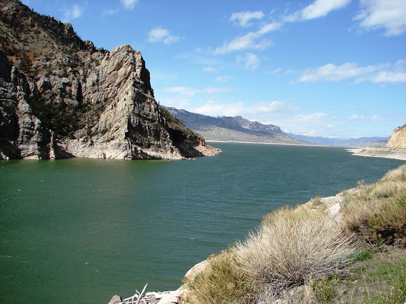
Placid water of the Buffalo Bill Reservoir.
Water surface covers approximately 8,000 acres. That’s a lot of land water!
The concrete arch-gravity Buffalo Bill Dam was one of the first conservation projects in the United States. Work began on it in 1905. When completed in 1910, it was the highest dam in the world at 325 feet.
A brochure at the Visitor’s Center explains the historic importance of the Newlands Reclamation Act as well as the difficulties of building such a high dam at the turn of the century.
A poster of an oil painting, commissioned after the dam was completed, shows just how otherworldly the area looks.
The original wood and concrete ball plug, once used to halt the flow of the Shoshone River at the dam, is on display in the parking lot. The dam, itself, built right into the craggy mountain rock, is an engineering feat. It’s listed on the National Register of Historic Places, as it should be, and is worth stopping to see.
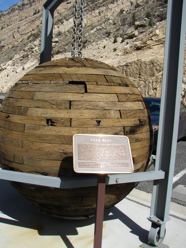
Original wood and concrete ball plug once used to halt the flow of water from the Shoshone River.
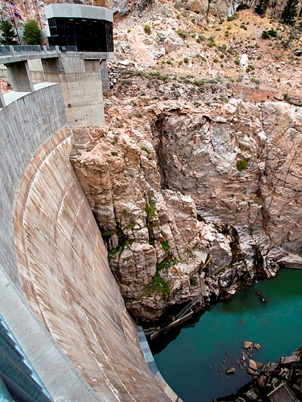
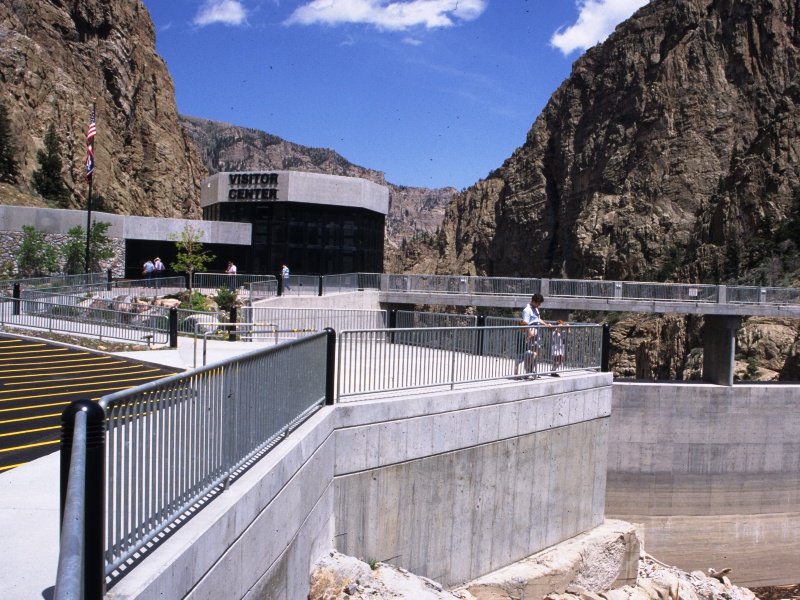
Downstream, showing the the canyon gorge and river. (Photo: Wikipedia)
Visitors to the dam can either walk to the Visitors Center or take a courtesy golf cart shuttle. The Center provides access to a platform where you can view the steep canyon gorge.
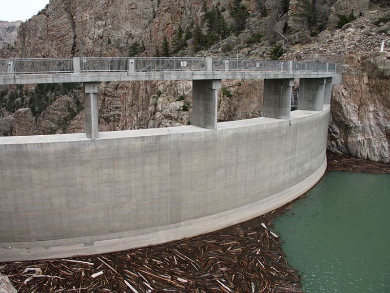
Upstream, facing the Buffalo Bill Reservoir.
(Photo: Wikipedia)
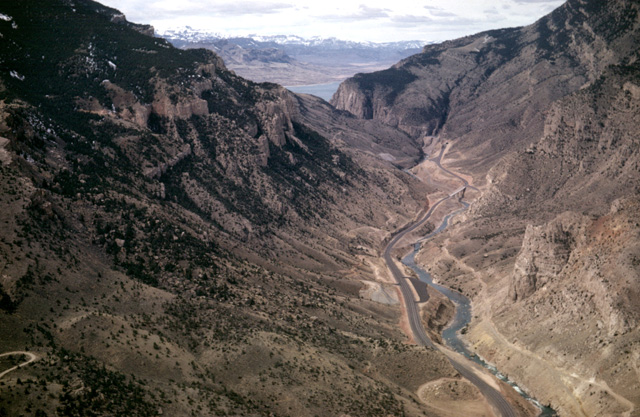
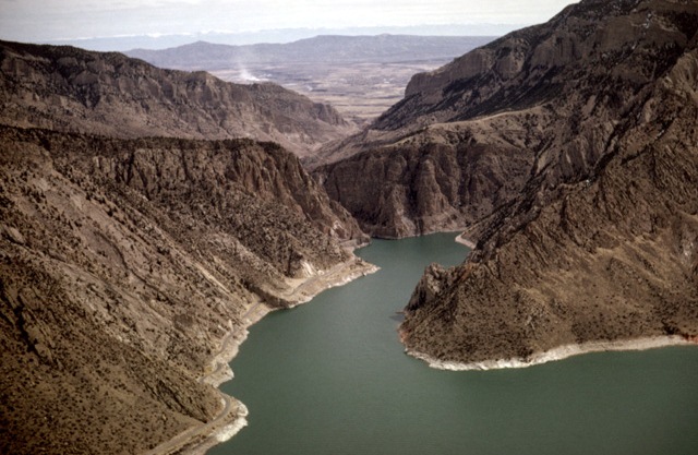
Aerial views of Shoshone Canyon and Buffalo Bill Reservoir
Photos: Copyright ©2001 Louis J. Maher, Jr., Geology by Lightplane.
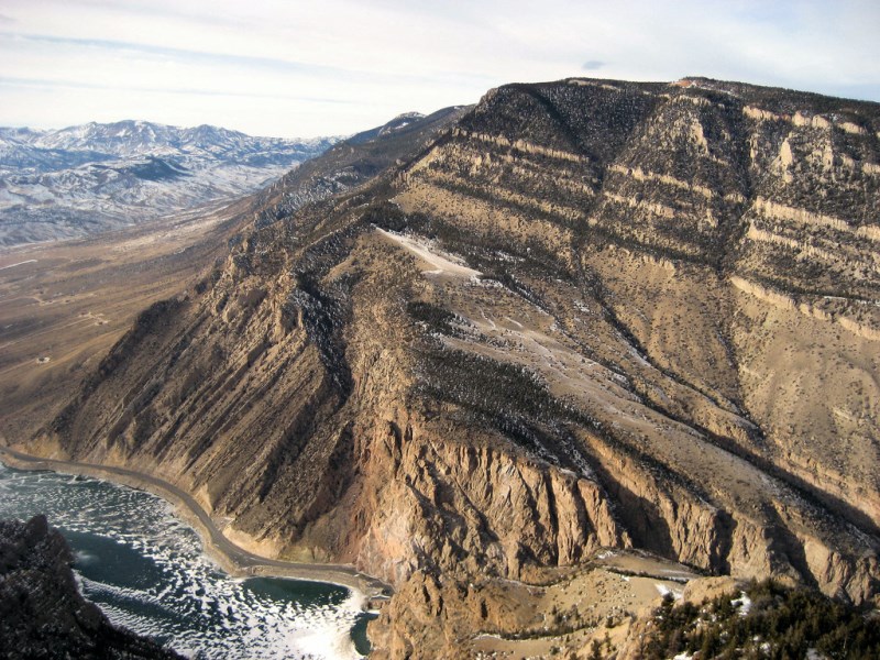
North Fork Highway hugs Rattlesnake Mountain’s spectacular south face, which rises over 3300 feet. (Photo: SummitPost)
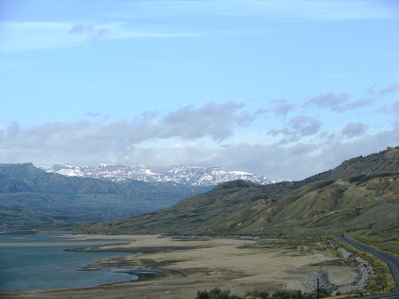
The highway follows the reservoir’s shoreline through Buffalo Bill State Park.
The landscape looked surreal . . . almost like an alien planet.
Mountains dominate the scenery. Elevations vary from approximately 5,400 feet in Buffalo Bill State Park to over 10,000 feet in the snowy Absarokas. The Absaroka Range, a large sub-range of the Rocky Mountains, is composed entirely of volcanic rock. The range borders Yellowstone on the east and extends from Wind River to the south all the way up to Montana in the north. The highest peak in Yellowstone, Eagle Peak, is in the Absaroka Range.
Buffalo Bill State Park surrounds the reservoir. The state park, reservoir, and dam were all named for the famous Wild West showman, William “Buffalo Bill” Cody, who once owned the land. Park amenities include picnicking, camping, windsurfing, trout fishing, and boating.
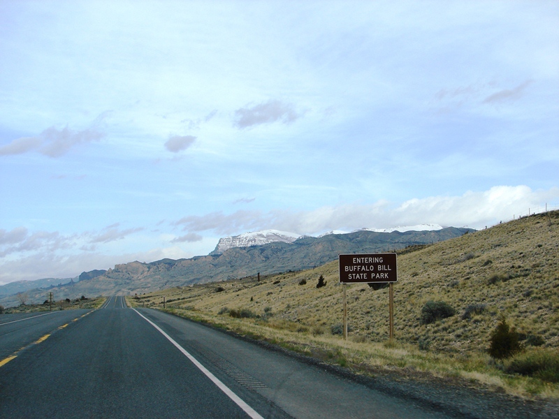
On the highway there is a single, simple sign announcing that you are entering Buffalo Bill State Park.
One thing great about this route, aside from the breathtaking views, is the absence of billboards, advertising, and other distracting road signs. No street lights either. We agreed it might be a good idea to find our way back to the hotel before dark.
Wapiti Valley
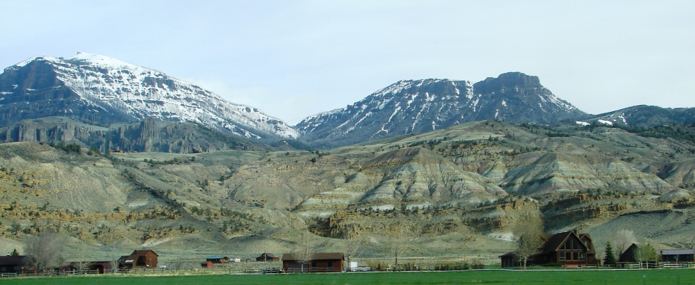
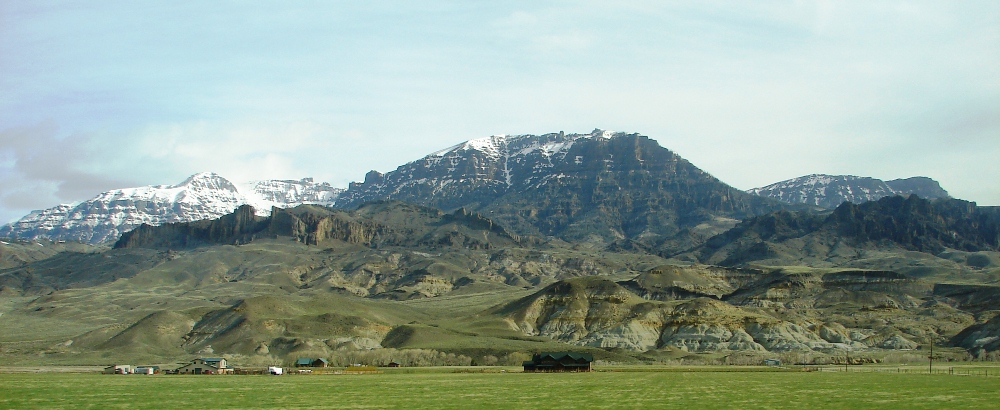
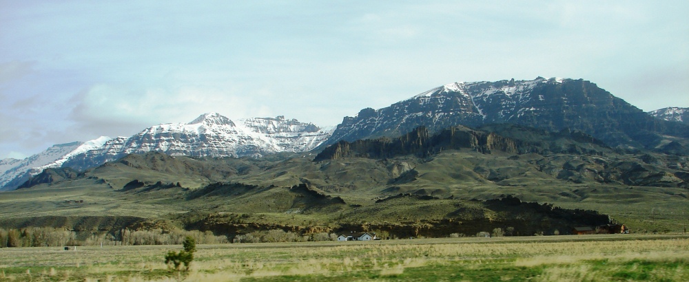
Past the state park, the landscape gives way to beautiful Wapiti Valley.
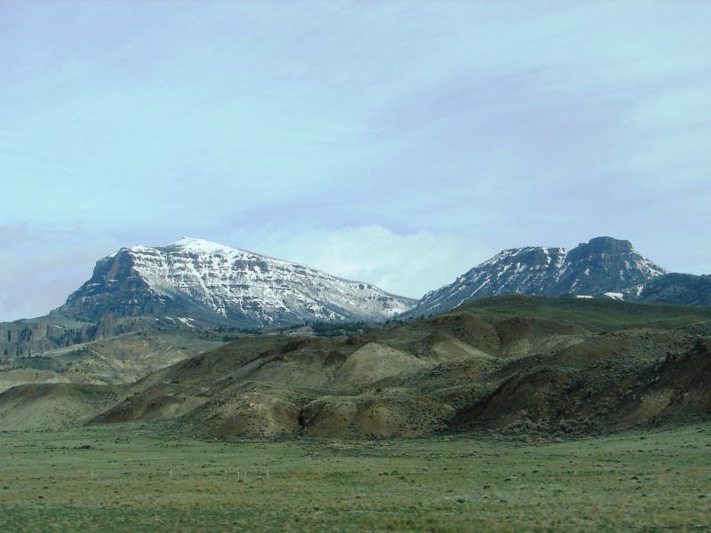
Snow-capped peaks of the Absaroka Range are the backdrop for rolling hills in Wapiti Valley.
Houses, homesteads, ranches, and resorts in Wapiti Valley are dwarfed by the snow-capped mountains of the Absaroka Range. The mountains frame the rolling, green-tufted hills and loom large on the horizon in every direction. The scenery is stunning.
Born and raised a city girl, it’s hard for me to imagine living in the shadow of mountains so far away from people, restaurants, hospitals, and stores. It’s a different kind of life, but I understand and appreciate why others would choose to do it.
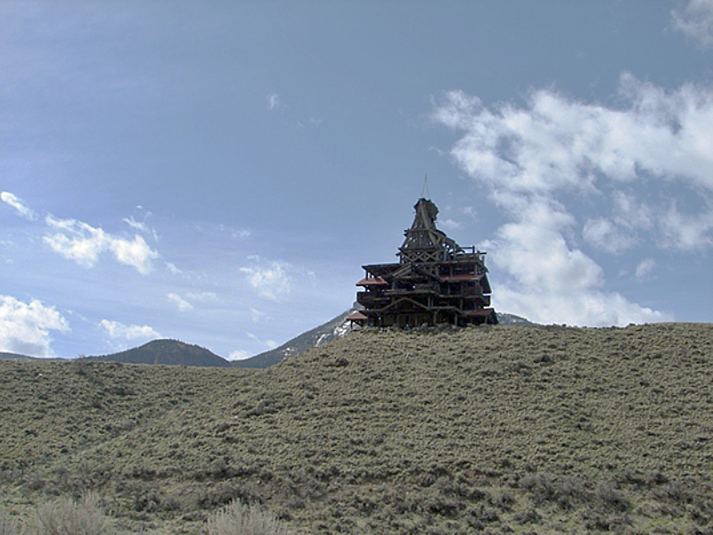
Smith Mansion, North Fork Highway, Wapiti Valley, WY.
On the south side of the highway, not far from Shoshone National Forest, there’s a lone structure called Smith Mansion. You can’t miss it. It sits high on a hill . . . all by itself . . . and is rather ugly. It looks unfinished with raw timber set at odd angles. Built by Francis Lee Smith, one log at-a-time, the whimsical house is a local landmark.
Shoshone National Forest
The North Fork Highway enters Shoshone National Forest about 24 miles west of Cody. At this point, the highway officially becomes the Buffalo Bill Cody Scenic Byway.
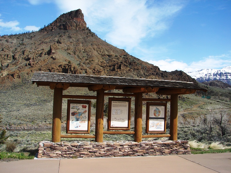
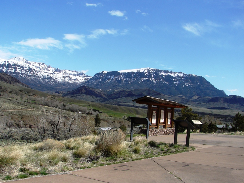
Information kiosk just inside the east entrance of Shoshone National Forest.
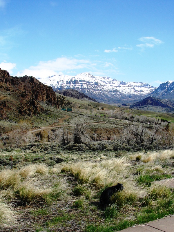
We stopped at an information kiosk to stretch our legs and walk our pup. Mitzi was such a trooper, putting a lot of miles under her furry belt. The mountain air was cool . . . clear . . . positively refreshing . . . and quiet. When you stop to listen, you realize there is total, absolute silence. It’s a slice of heaven in the mountains when no one else is around.
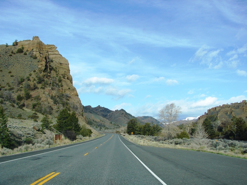
Buffalo Bill Cody Scenic Byway with the Holy City rock formation just visible on the right.
Buffalo Bill Cody Scenic Byway continues to follow the North Fork of the Shoshone River for another 27.5 miles, winding its way through the forest to Yellowstone’s East Entrance. I immediately went on high alert for bear, buffalo, and the bighorn sheep that like to traverse rocky mountain cliffs. The route is known for both its abundant wildlife and amazing rock formations. One formation, the Holy City, can be seen from the road.
We didn’t stop, but it’s worth seeing
Resembling a silhouette of the ancient city of Jerusalem, the Holy City formation was created millions of years ago by violent volcanoes that erupted one after another, leaving a thick, soupy mix of breccia over the entire region. As the breccia cooled, runoff from the mountain streams carved the formation.
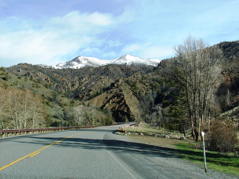
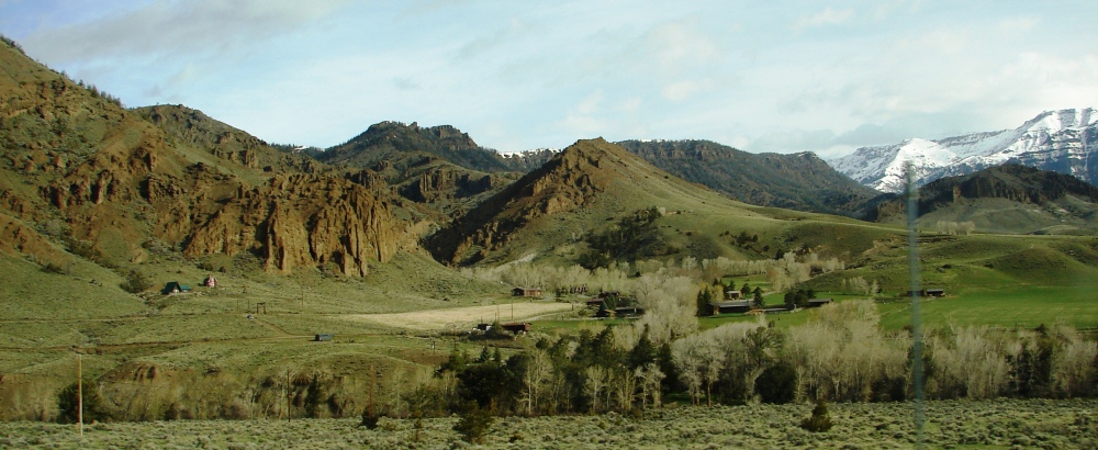
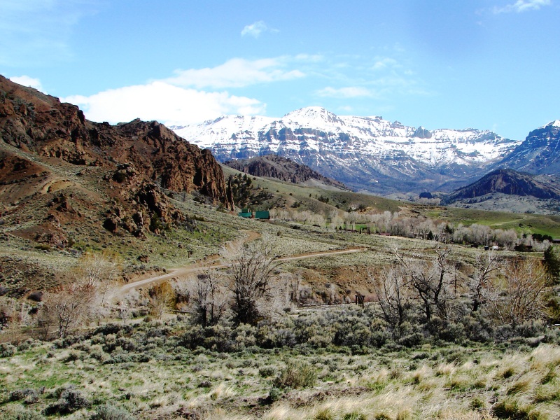
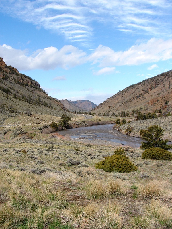
The landscape in Shoshone National Forest seems to change with every turn.
Shoshone National Forest consists of 2.4 million acres of pristine wilderness. Immense areas of exposed rock are interspersed with hillsides, thick forests, and meadows. Rugged mountains frame the horizon. The higher peaks are snow-clad most of the year. Honestly, it is astonishing how beautiful the scenery is. Until you see it for yourself, you cannot imagine its beauty. Photos, certainly not mine, don’t do it justice.
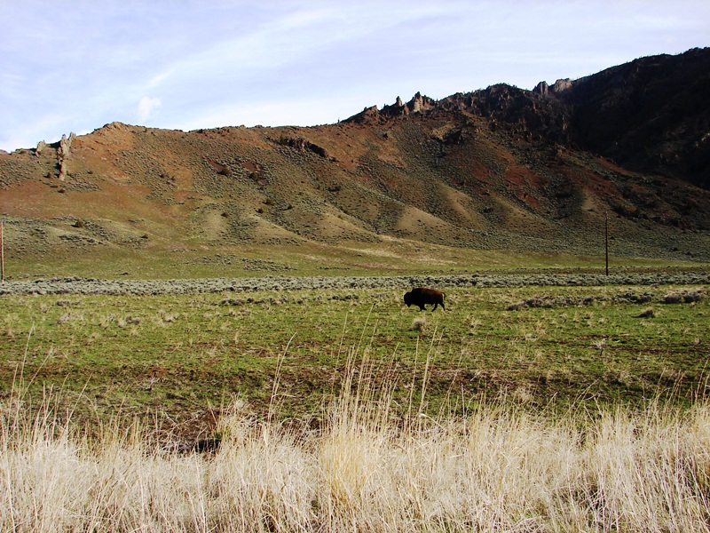
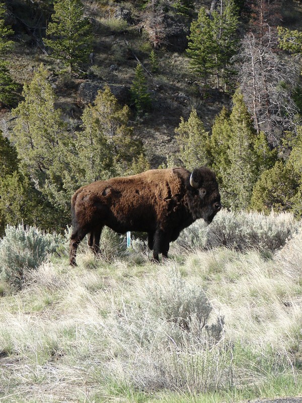
Imagine my delight at our first sighting of free-roaming American bison.
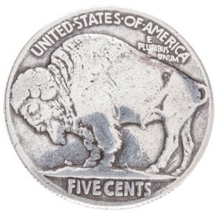 We saw deer, antelope, moose, and a herd of elk, who took off running the minute they heard me squeal with delight. Shortly thereafter, we enjoyed a closer view of American bison. When you squeal with delight at seeing one, they just stand there and ignore you. It’s typical to see the bison just standing there as if posing for the buffalo-head nickle.
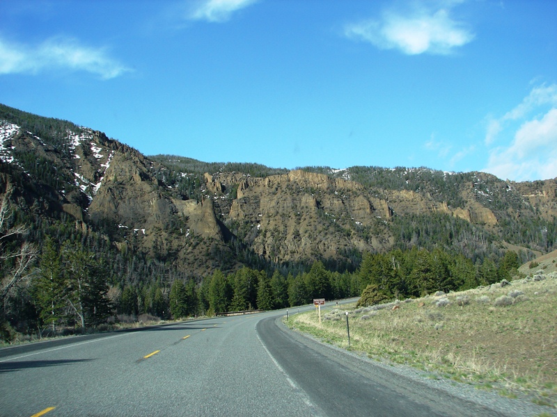
Near Newton Springs picnic area, the air was noticeably cooler and the lower mountains had snow.
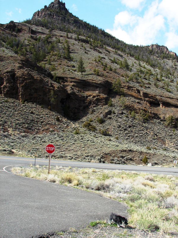
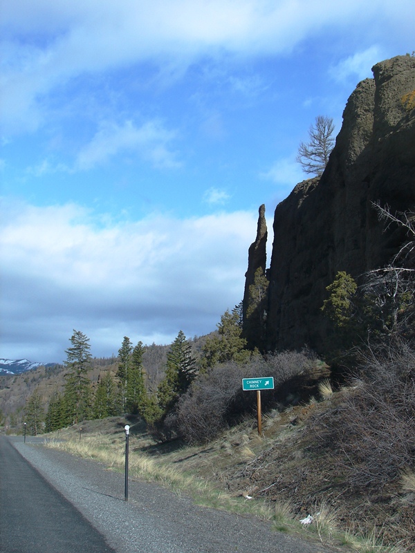
Chimney Rock, not far from Yellowstone, looks like it might be a hoodoo, one of many unearthly rock formations that are a common sight along the Buffalo Bill Cody Scenic Byway. There’s so much to see, it’s impossible to capture it all. What’s really striking is how diverse the landscape is—one minute you’re looking at cliffs, the next forests, mountains, meadows, and rolling hills. Everywhere you look, everything is beautiful.
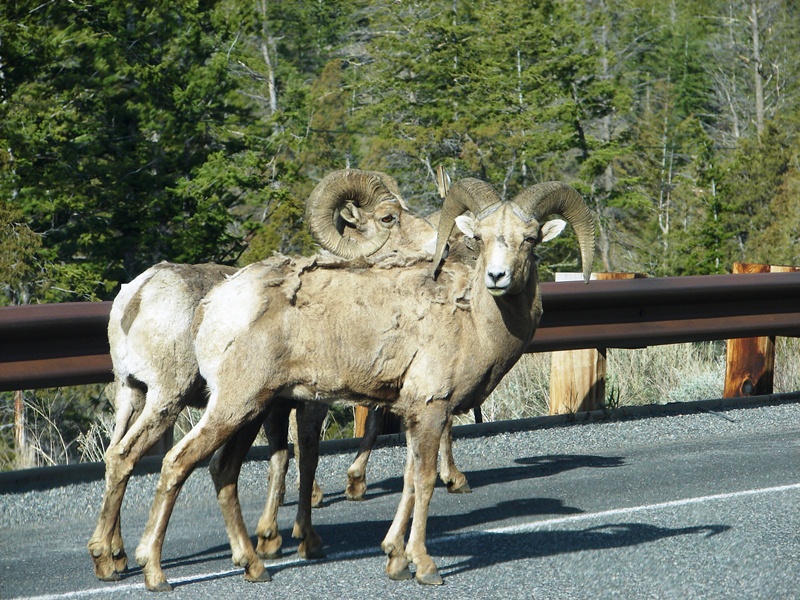
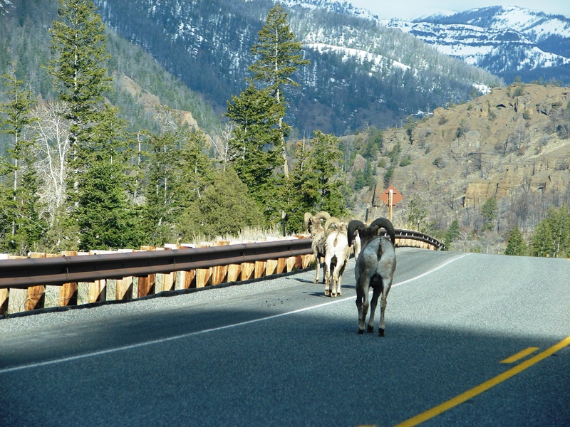
Sheep, of the Rocky Mountain Bighorn type, up close and personal.
At one point, a rather large herd of bison meandered on by as if they owned the road. Bison weigh up to 2,000 pounds and can sprint 30 miles per hour. Since we heard they are dangerous and unpredictable, we didn’t take any chances or try coaxing them over for a closer look. The view from our car was close enough.
It’s bison, not buffalo. Though the terms are often used interchangeably, buffalo and bison are distinct animals. How do you tell the difference? Bison have large humps at their shoulders and bigger heads than buffalo. They also have beards, as well as thick coats which they shed in the spring and early summer. Read more
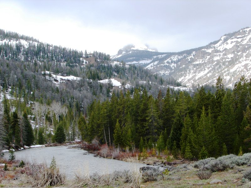
Washakie Wilderness and North Fork of the Shoshone River
The wilderness beckons. A comprehensive system of trails, for back country hiking, can be accessed directly from the road. Or you can simply get out of your car and take a short, leisurely stroll along the Shoshone River.
If you’re more adventurous and don’t mind high-risk, you can make like a mountain man and explore the vast, truly rugged, and remote areas. It’s your choice—you have the Washakie Wilderness to the south and the Absaroka Wilderness to the north. Both are death-defying.
Whatever you do, keep in mind, this is serious bear country.
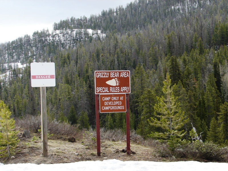
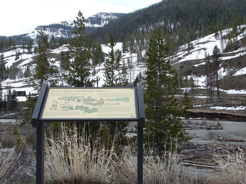
Bear warning signs . . . and snow . . . near the entrance to Yellowstone.
Shoshone National Forest, with its surrounding wilderness, is said to have the highest concentration of grizzly bears in the continental USA. Warning signs are posted everywhere. One sign on the road read: Bears are dangerous . . . do not approach . . . up to $5,000 fine. Translation: You WILL be fined up to $5,000 if you try to get in too close for a photo, that is, if you live to tell about it. Not a problem for me. I have an adequate zoom lens I intended to use if, and when, we ever saw a bear.
We missed it, but it’s worth seeing
Once Buffalo Bill Cody’s hunting lodge, Pahaska Teepee is now a mountain resort with rustic cabins, horseback riding, fishing nearby. and an onsite restaurant, offering home-cooked meals, that is open to the public. Built in 1904, it is nestled among the tall pines at the foot of majestic Cody Peak, just two miles outside of Yellowstone.
Yellowstone National Park
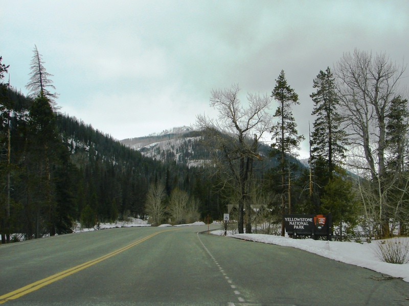
Snow in Yellowstone National Park.
We weren’t surprised to see snow in Yellowstone. Yellowstone sits on a volcanic plateau, at an average elevation of 8,000 feet above sea level, and it’s bordered on nearly all sides by tall mountains. The air is thinner, cooler. Spring arrives more slowly, and it’s not unusual for the mountains to have snow in the middle of May.
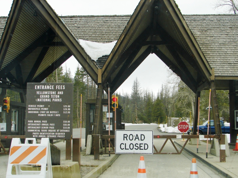
Bleh. They won’t let us in.
Crews working to clear 20 feet of snow at Sylvan Pass on May 16, 2011.
(Photo: WyoFile)
Now we were surprised—the East Entrance was closed. Multiple avalanches a few days before had blocked the road at Sylvan Pass, and the ranger said they were still trying to clear the snow. This explained why we had not seen even one car on the highway. Apparently, everyone knew . . . except us. Major disappointment.
It was all my fault. Before our trip, I had done extensive research, and everything I read had warned about snow. The park recommends that you call a day ahead to check weather and road conditions. So, why didn’t I listen?
Hope springs eternal
Sensing our dismay, the ranger suggested we try another entrance. All of the other four—South, West, North, and Northeast—were open. He even called to confirm that there were no other closings.
From Cody, South and Northeast were the two closest entrances. The South Entrance was 6+ hours away and not a viable option. But the Northeast Entrance was just four hours (round trip). And it was still early enough in the day to get there, see the park, and make it back to Cody before dark.
So we turned around and headed back to Cody . . . drove straight through town without stopping . . . and kept on driving, north by northwest, in hot pursuit of that Northeast Entrance. After all, we hadn’t come all this way NOT to see Yellowstone.
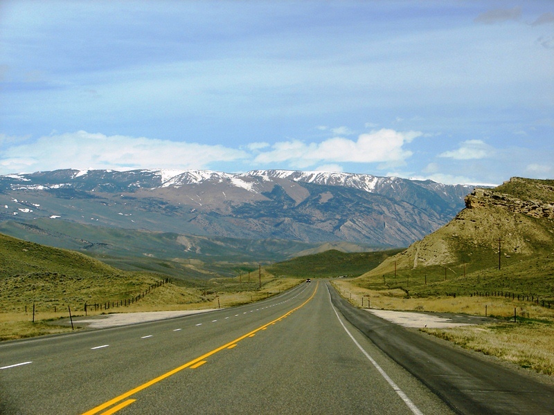
Heading out of Cody, north by northwest, deeper into the mountains to Yellowstone’s Northeast Entrance.
Maps and some photos were found online. Links to the source sites have been provided. I encourage you to visit these sites to read what others have to say about wild, wondrous Wyoming.
America’s Byways | City-Data | karma17 | Wikipedia | Wyoming Tourism | Yellowstone National Park
Poem: “This God-Forsaken Land,” Author unknown, Frank J. Meyers papers, circa 1919-1945 via American Heritage Center.
Similar posts you might like
We knew Yellowstone National Park was going to be something special to see,...
After three glorious days driving through wild, wondrous Wyoming, my lastin...
Wyoming. Awesome and incredibly beautiful. Who knew? Read more
When you’re hot on the trail to Yellowstone National Park, you don’t go hom...



We are going in August and this story is great, we are making Cody a base camp, hope it works for us too. Thanks.
We enjoyed Cody. The trek west to the East Entrance of Yellowstone is breathtakingly beautiful. If you start early enough, you should be able to make it to Old Faithful and back in a day. If you have the chance, try the Northeast Entrance, too. You’ll take the Chief Joseph Scenic Parkway. I highly recommend stopping, standing on a ridge, and seeing nothing but mountains for miles. In every direction. It’s stunning.
January 2022
We are planning to go to Yellowstone in the spring. I enjoyed your trip and photos so much we will follow your trail.
I thank you for taking us on a nice trip in 2011.
Cindy
Thinking of taking that route to enter park next summer towing small fifth wheel. Love your blog & and are using it to plan day trips. Any idea where I can find height of tunnels?
Hi Karen, How exciting! You’re going to love Cody and Yellowstone. We were traveling by car and didn’t need tunnel heights. But I did a quick google search and found information at
RVNet.comthat might help answer some of your questions. Enjoy your trip…and be sure to allow time to stop along the way to take in the sites. There’s so much to see that the ‘designated driver’ misses while watching the road.