
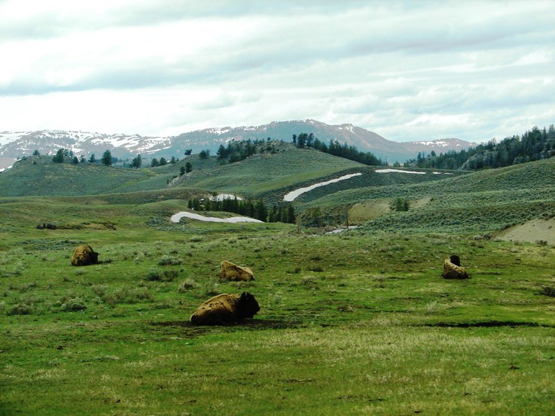
American bison resting in Yellowstone National Park.
. . . Road Trip thru Wyoming . . .
May 15-16-17, 2011
Day Two (con’t): An Afternoon in Yellowstone
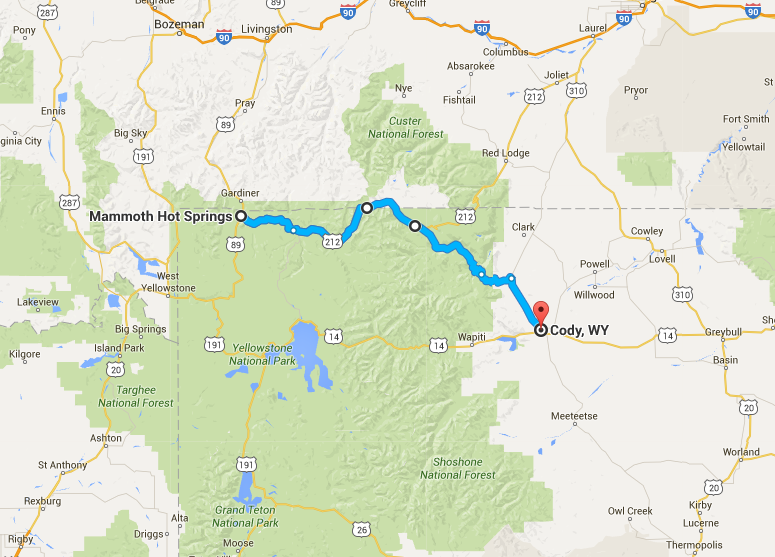
Monday, May 16, 2011 . . . When we couldn’t get into the park using the East Entrance, we headed north-by-northeast to Yellowstone’s Northeast Entrance. In Yellowstone, we went as far as Mammoth Springs. Then, because of time constraints, we turned around and retraced our way back to Cody before it was dark.
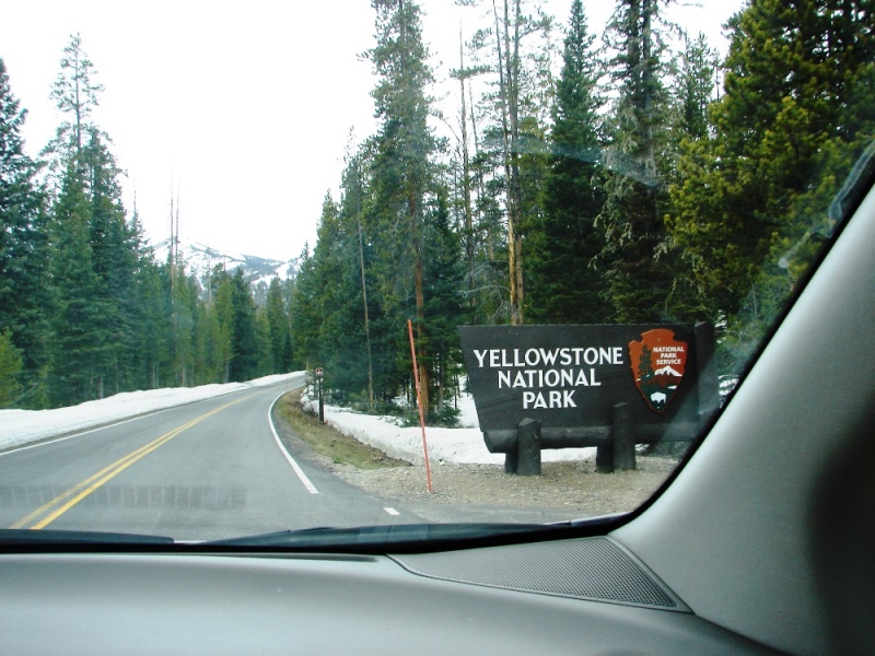
After almost 4 hours on the road, Yellowstone’s open Northeast Entrance was a sight for celebration.
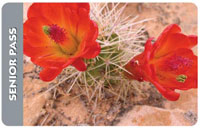 TRAVEL TIP: In case you didn’t know . . . Yellowstone and other national parks charge entrance fees. If you are a U.S. citizen or permanent resident age 62 and over, you can purchase a lifetime Senior Pass at the gate for just $10 (or $20 via snail mail). The pass provides free access for life to all national parks and federal recreation sites. Read more
Almost immediately, we were surrounded by tall forest trees and snow-covered mountains. Back in Cooke City, we had signed up for a Verizon self-guided GPS tour. Don’t do it. It didn’t work. There is no Verizon cellphone service in Yellowstone.
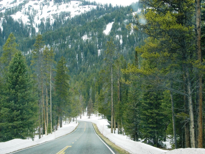
Forest trees and mountains rise above the road to form a canyon.
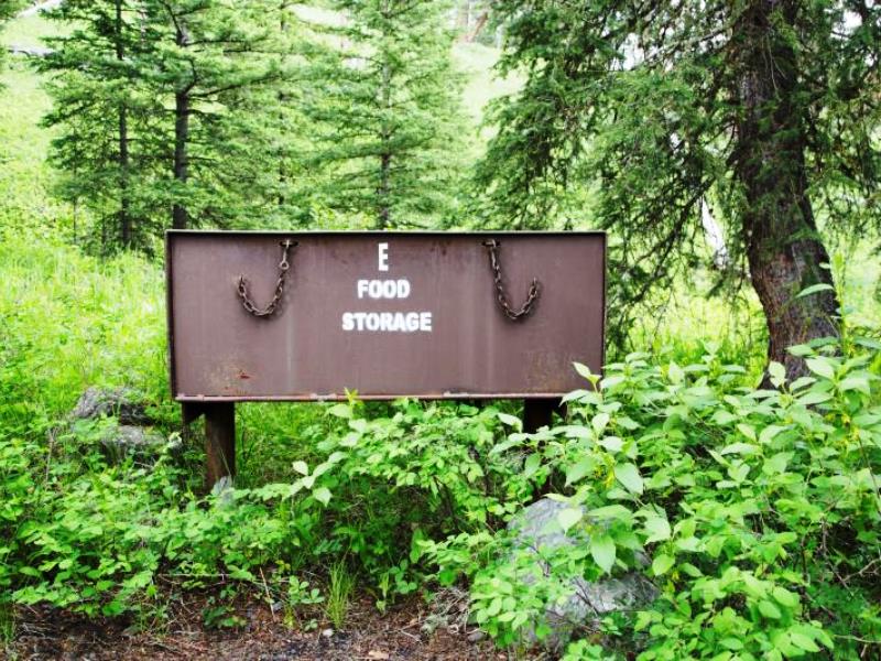
There were plenty of signs warning about bears, forest fires, wildlife on the roadway, using pullouts, driving slowly, and camping only in designated areas.
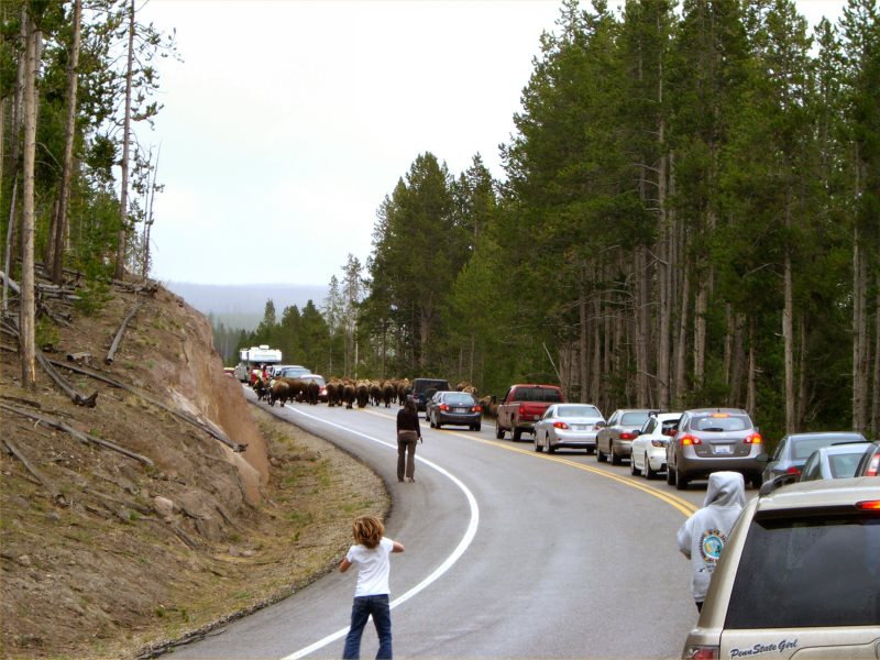
Some people are polite and pull over to the side of the road when they want to take photos; others come to a dead stop right where they are.
Bison and bear jams are common. Also common are wildlife on the road. Be prepared to stop and wait.
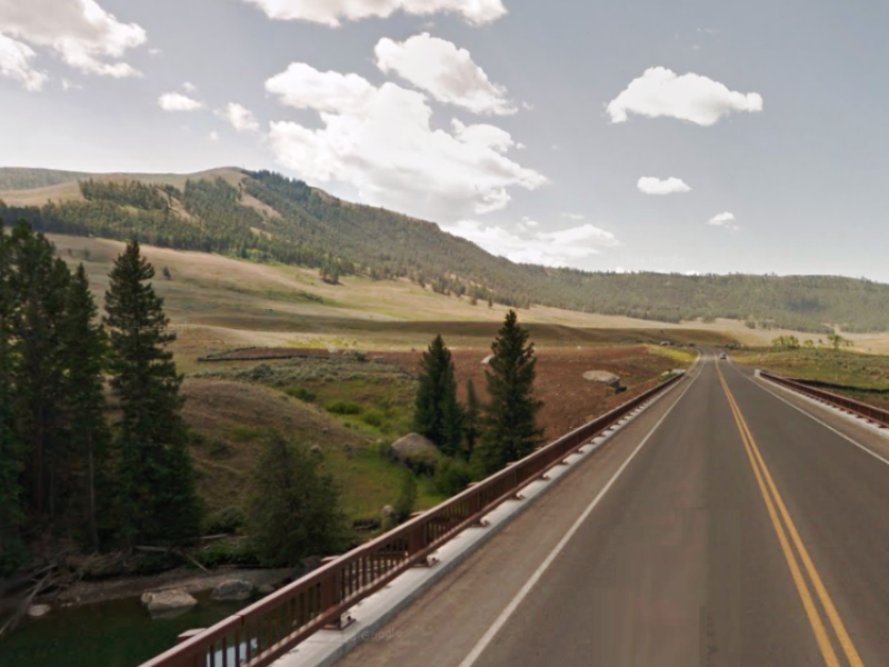
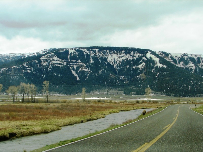
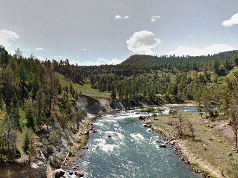
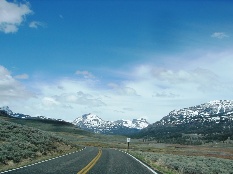
As the road winds southwest through the park, it follows Soda Butte Creek.
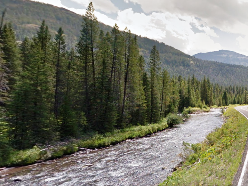
Soda Butte Creek is a popular fishing spot for catching native Yellowstone cutthroat trout.
Campers might want to know
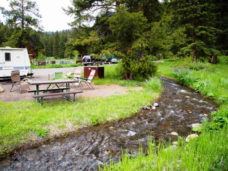
 Pebble Creek Campground is located near Yellowstone’s Northeast Entrance in a lovely wooded setting next to a bubbling brook. It’s the main choice for camping near Lamar Valley, and sites fill quickly during peak summer months. Read more
Lamar Valley
Just beyond Pebble Creek Campground, the road enters beautiful Lamar Valley. Lamar Valley is widely known as one of the best places in Yellowstone to view wildlife, especially grizzly bears and wolves.
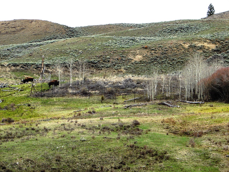
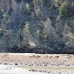
Our first sighting of something wild in Yellowstone.
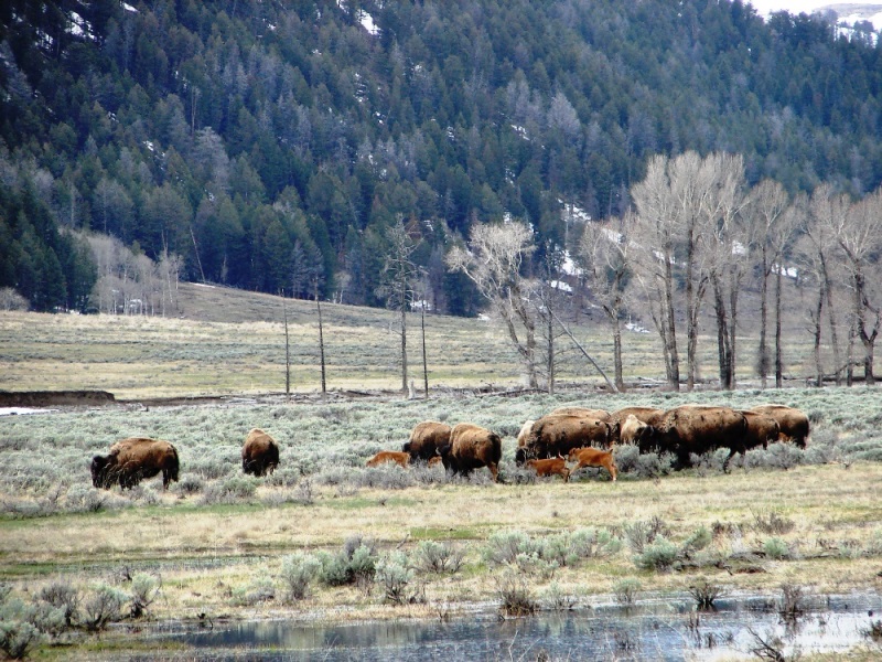
American bison and their calves grazing in Lamar Valley. Female bison give birth in April or May. If you want to see bison babies, mid-May is a good time to visit Yellowstone.
There were plenty of bison in the Lamar Valley, but we did not see even one bear or wolf. People, parked on the side of the road with binoculars and long-lens cameras, may have been watching something in the distance. We could not stop. When you’re on a mission to see as much of Yellowstone as you can in the little time you have to do it in, you miss much.
We missed it, but it’s worth seeing
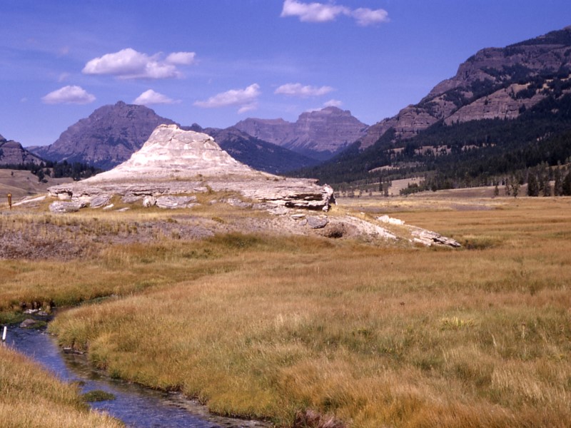
Soda Butte, an extinct geyser, sits in Lamar Valley near the mouth of Soda Butte Creek. It’s made of travertine and formed when hot springs of calcium-rich water bubbled up to the earth, then cooled down. Though no longer active, you can still smell sulfur emitting from the vents. A pullout on the road provides parking for a closer view/smell.
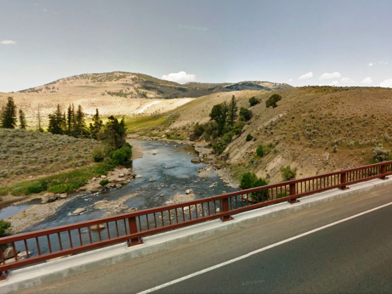
The Lamar River is a tributary of the Yellowstone River and popular spot for fly fishing.
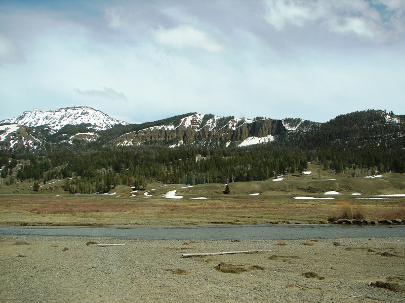
Crossing the Lamar River, Amethyst Mountain and Specimen Ridge come into view.
 Amethyst Mountain is famous for its abundance of amethyst, opal, and petrified wood. At 9,609 feet, the mountain is the highest peak on a long ridge consisting of the Mirror Plateau, Amethyst Mountain, and Specimen Ridge.
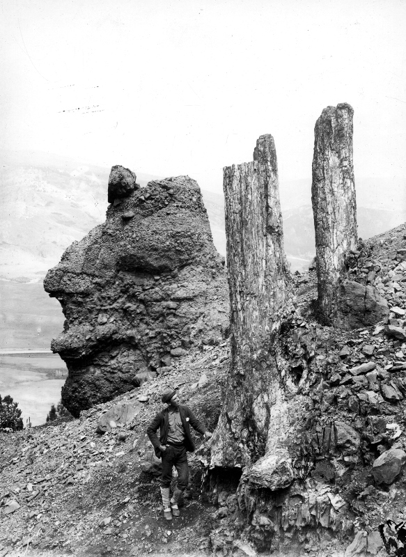
Extensive exposures of ancient tree stumps standing upright on the northeast slopes of Amethyst Mountain are known as the Fossil Forest. The area with concentrations of petrified wood are known as Yellowstone’s Petrified Forest.
We missed it, but it’s worth seeing
The remains of hundreds of 50-million-year-old trees—the largest concentration of petrified trees in the world—stand exposed on the slopes of Amethyst Mountain. The trailhead for the three-mile Specimen Ridge Day Hike is located at the first pullout past the Lamar River bridge. It’s a steep 1,100 foot climb, but sweeping views at the summit are said to be awesome.
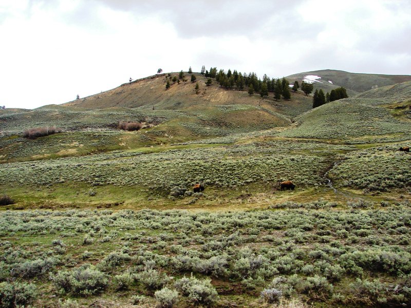
Specimen Ridge towers over the Lamar Valley as a lone bison grazes near the Lamar River.
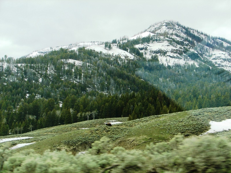
Yellowstone is huge and impressive.
You don’t realize just how huge the park is until you’re driving through it.
It’s over 2.2 million acres of wilderness, and spans parts of three states: Wyoming, Montana, and Idaho.
There are mountains all around, deep valleys and canyons, hot springs and geysers, cooled and hardened lava flows, rolling hills, rivers, lakes, waterfalls, forests, meadows, and wildlife everywhere.
Don’t expect to see it all in a day or two.
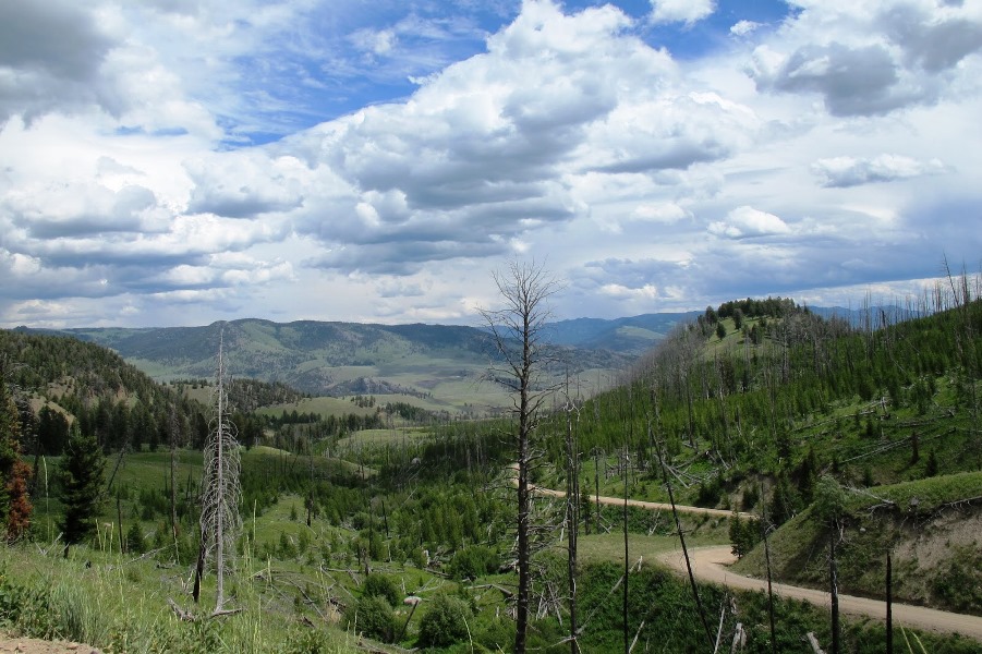
For perspective . . . The Lamar Valley, the area we were driving through, is only a small section in the far northeast corner located between the Northeast Entrance and Roosevelt. The road we were on is just visible at center-right in the photo below.
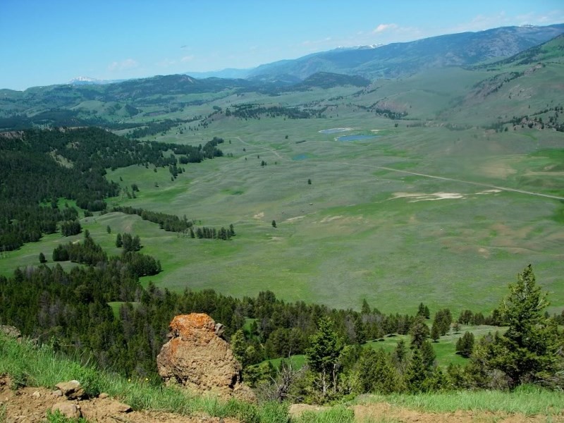
View of the Lamar Valley from Specimen Ridge looking northwest. Highway 212—the only road into the park from the Northeast Entrance—is that thin ribbon of road just visible at center-right.
For the serious hiker
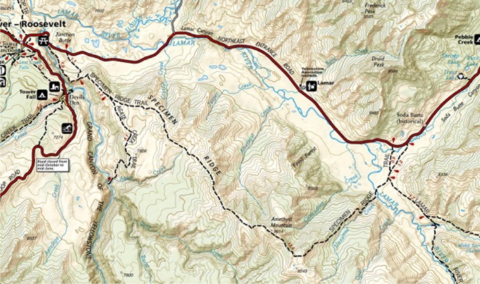 There is another, more-strenuous 16.9-mile Specimen Ridge Trail. It encompasses vast rolling hills and extends the length of Specimen Ridge, topping out on Amethyst Mountain after 10 miles, then continues down into Lamar Valley, and ends at the Lamar River. Trailhead is two miles east of Tower Junction, just before you cross the Yellowstone River bridge.
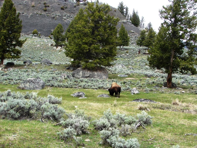
American bison grazing on a hillside.
 TRAVEL TIP: Wild animals, especially females with young, are unpredictable and dangerous. Keep a safe distance and do not approach bears or wolves on foot within 100 yards or other wildlife within 25 yards. Use roadside pullouts and binoculars or telephoto lenses for safe viewing. If you cause an animal to move, you are too close! Read more
Upstream, the Yellowstone River tumbles over waterfalls as it passes through the Grand Canyon of the Yellowstone.
Upper Grand Loop
Leaving Lamar Valley, we arrived at Tower Junction to find the road south to Tower Fall closed due to mudslides. This meant there would be no viewing the Grand Canyon of the Yellowstone or its waterfalls. We turned right on Grand Loop Road and headed northwest towards Mammoth Hot Springs.
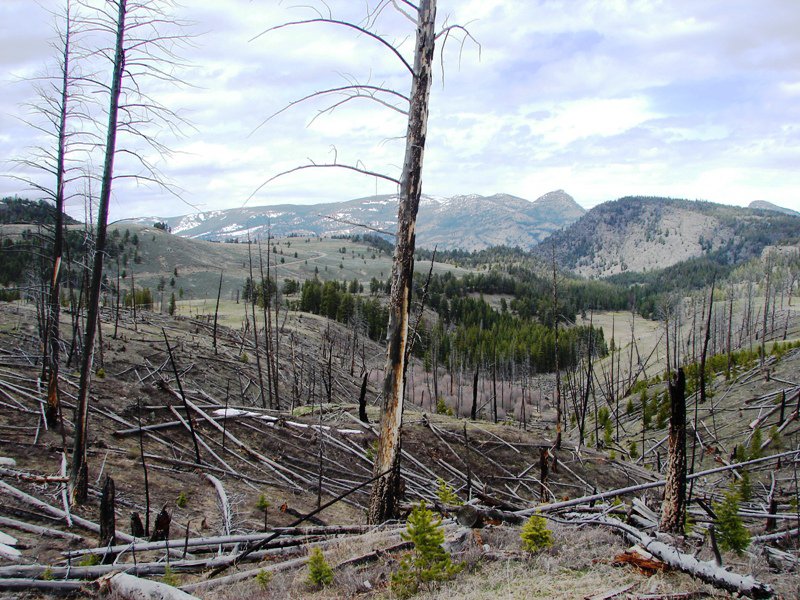
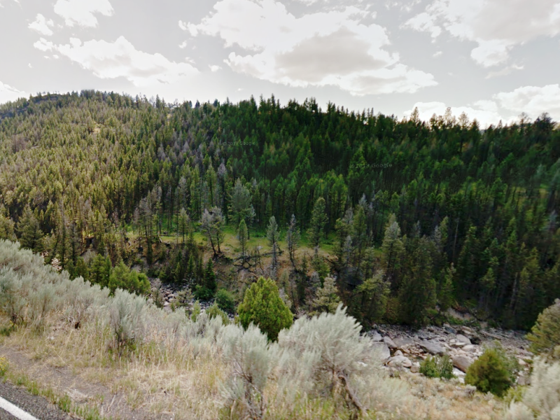
Evidence of forest fire visible from the road.
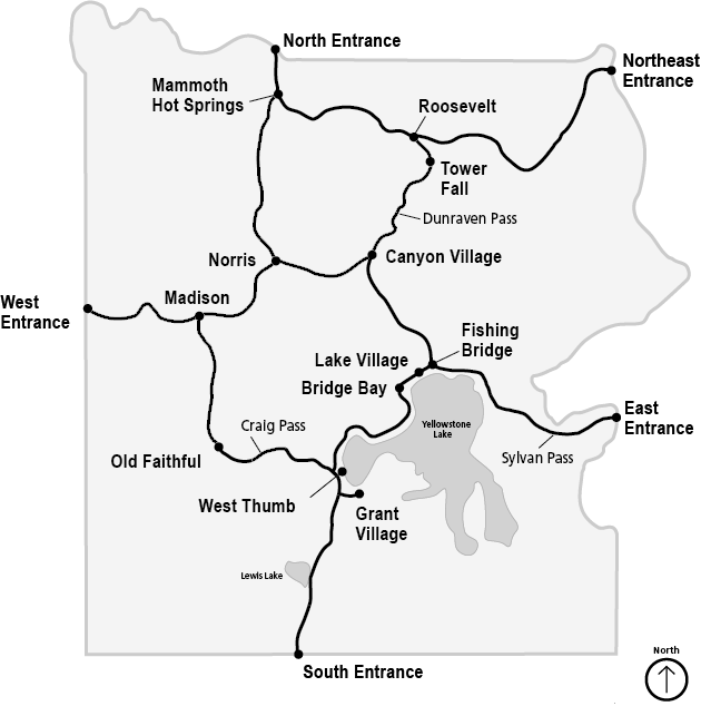
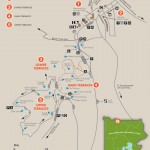
Grand Loop is the main road in Yellowstone. To get to it, you take one of the five entrances into the park. The loop is approximately 142 miles long and shaped somewhat like a figure eight. It winds through the park past all of the popular scenic sites. Speed Limit is an average 45 mph, but because of winding turns, the scenery, and wildlife on or around the road, it takes anywhere from 4-7 hours to drive the entire loop. We were on the upper-most portion of it, between Roosevelt and Mammoth Hot Springs.
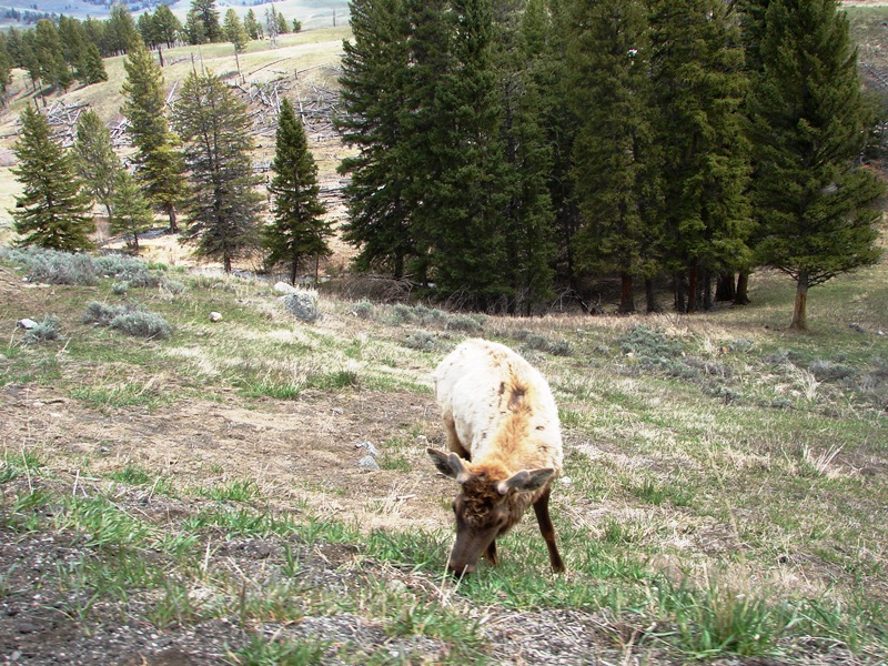
A furry creature on the hillside.
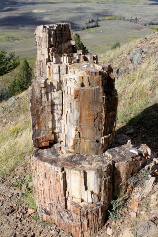
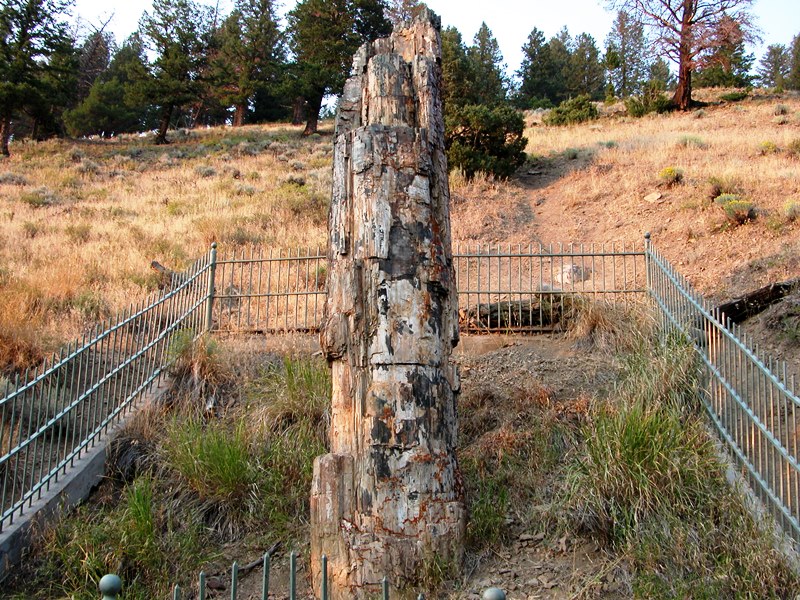
One roadside natural attraction is the Petrified Tree. It’s right off Grand Loop Road, about a quarter-mile down a paved, dead-end road near Lost Lake trailhead. Small cars only—there’s no way for anything larger to turn around. Trailers and large vehicles can use the small pullout on Grand Loop at the start of the road.
The Petrified Tree is similar to many of the trees found on Specimen Ridge. This tree—now solid rock—is tens of millions of years old and was once a giant redwood surrounded by a forest of trees just like it. During violent volcanic eruptions millions of years ago, mudflows and volcanic deposits rapidly filled the open pores of the tree, solidifying it into a rocky trunk. At one time, there were two trees standing at the spot. However, during the park’s earlier days, visitors and explorers took pieces of the second tree until there was nothing left. Today, a fence surrounds the remaining tree to protect it.
Lakes along the upper Grand Loop
Floating Island Lake is a favorite haunt for moose, nesting sandhill cranes, and trumpeter swan.
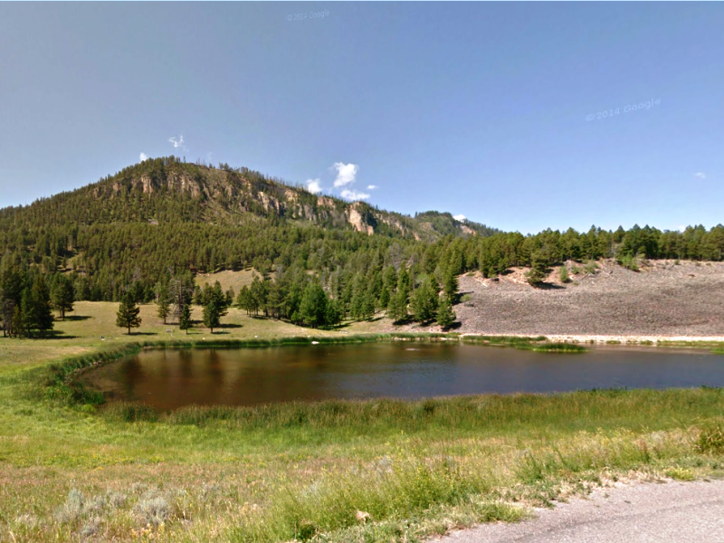
Floating Island Lake is named for the islands of floating vegetable matter—moss, bacteria, other plant life, and debris—that attract wildlife. Behind the lake is Crescent Hill (elevation 7,851 feet).
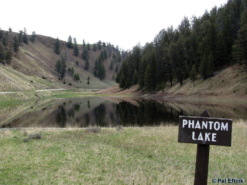
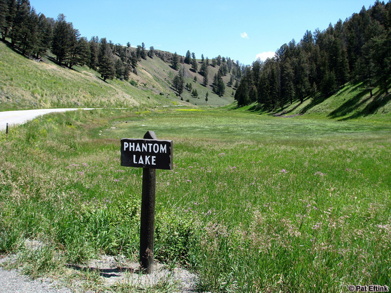
Further up on Grand Loop Road is Phantom Lake, a glacial depression named for the spring snow melt that disappears by August. It’s hard to call it a “lake” when all you see is a low-lying meadow. Below are two photos taken by Pat Eftink on May 24, 2009 and July 25, 2009, respectively.
Blacktail Pond can be seen from the road. The pond is boggy for most of the shoreline and looks like a marsh. I admit, I almost missed it. Without the sign (which calls it Blacktail Lakes), we would have driven on by none the wiser.
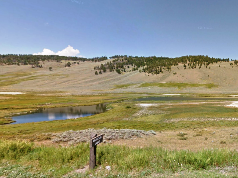
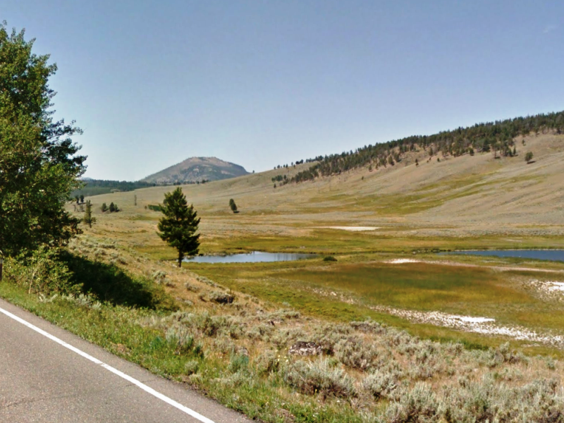
Beyond Blacktail Pond, in the far off distance, is Bunsen Peak (elevation 8,564 feet).
There are plenty of pullouts on the upper Grand Loop where you can stop and rest, check your map, have a bite to eat, or just sit and enjoy the scenery.
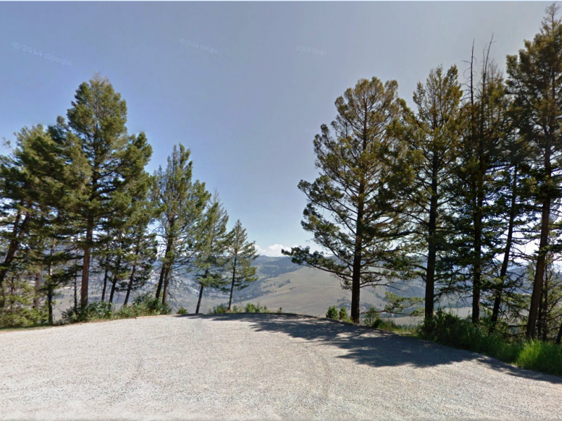
Pullout offering a sweeping panorama of the valley below.
We missed it, but it’s worth seeing
Wraith Falls is a short, easy half-mile hike from Grand Loop Road. The falls, a 100-foot streaking cascade formed by Lupine Creek, flows down a rocky section of hillside at the edge of Blacktail Deer Plateau. As the creek water spreads itself out across the cliff face, it creates a white, almost ghostly effect. Definitely a photo op.
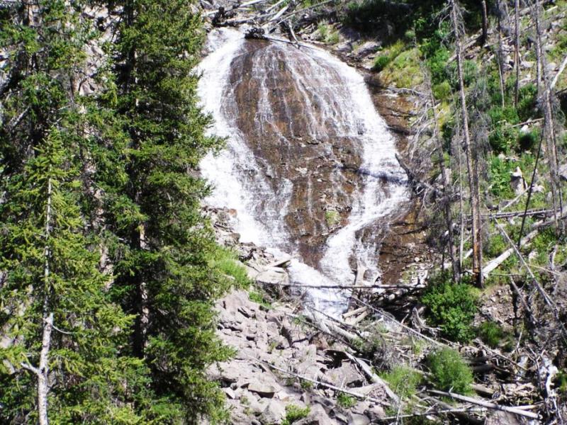
It was named in 1885 by geologist Arnold Hague for the mythical water nymphs who, in folklore, lived around waterfalls and could gain mortal men’s souls by marrying them and bearing their children.
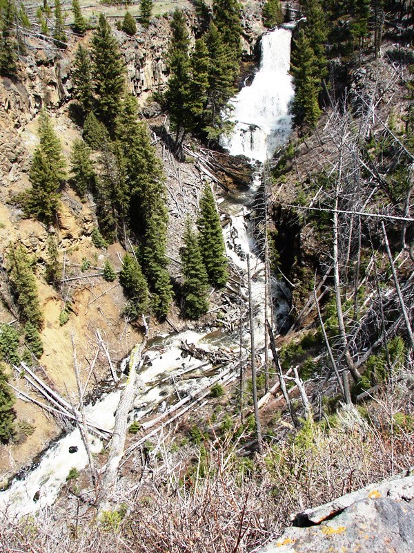
The falls descend in three plunges as Lava Creek spills over the cliff face—the upper terrace is 60 feet high . . . the lower is 50 feet. The cliff face is the result of a lava flow that happened over 500,000 years ago.
Another way to get to the falls is the Lava Creek Trail, a moderate-to-difficult hike from Mammoth Hot Springs through a significantly steep canyon alongside the Gardner River.
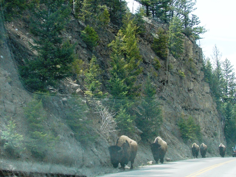
Right around the corner from Undine Falls, look who we met up with on the road.
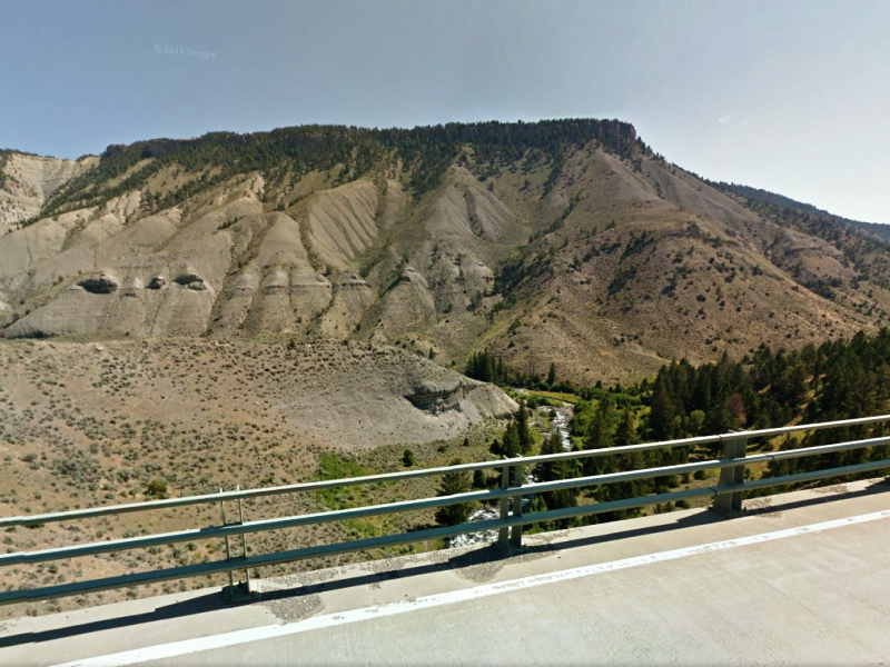
Crossing the Gardner River on the Sheepeater Canyon Bridge, just outside Mammoth Hot Springs. The steel bridge rises about 200 feet above the Gardner River.
Across the Gardner River valley is Mount Everts (elevation 7,846 feet). The peak was named for Truman C. Everts, a member of the Washburn–Langford–Doane Expedition of 1870, who had been lost in Yellowstone for 37 days.
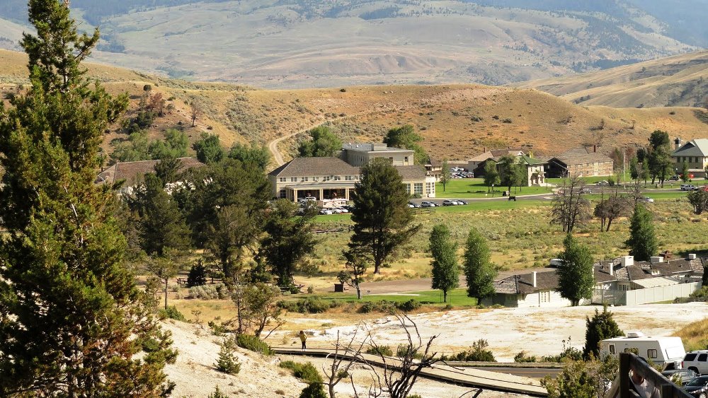
Mammoth Hot Springs
 The Mammoth Hot Springs area of Yellowstone is known for its spectacular travertine terraces and pools. It is also the site of the administrative and concession headquarters for all of Yellowstone National Park.
Located in the Mammoth Hot Springs Historic District, you’ll find old Fort Yellowstone, where 35 buildings remain from the 1890s and early 1900s when the U.S. Army administered the park.
The buildings are now being used as headquarter offices, a visitor center, and staff accommodations.
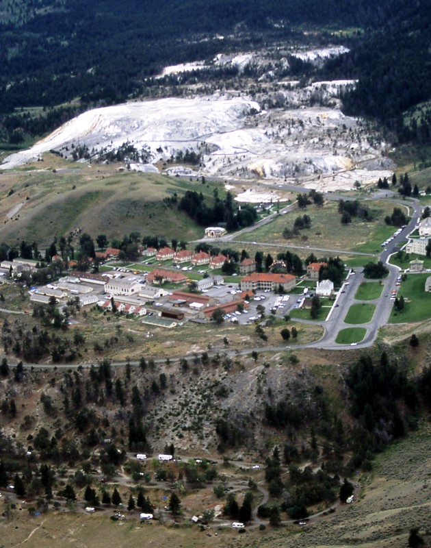
Aerial view of Mammoth Hot Springs.
(Photo: Jim Peaco)
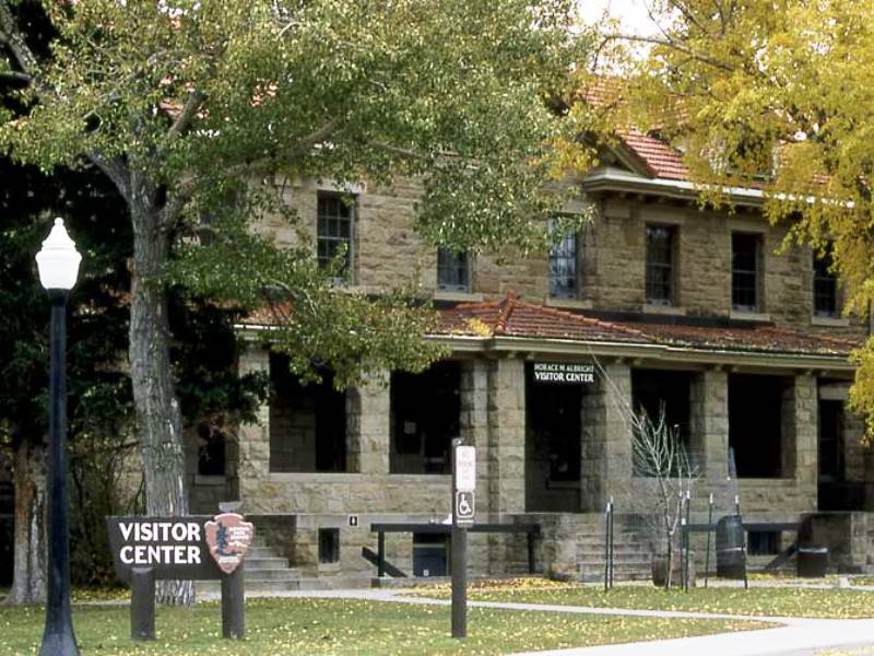
The Albright Visitor Center, built in 1909, was once the U.S. Army’s bachelor officers’ quarters. (Photo: Jim Peaco)
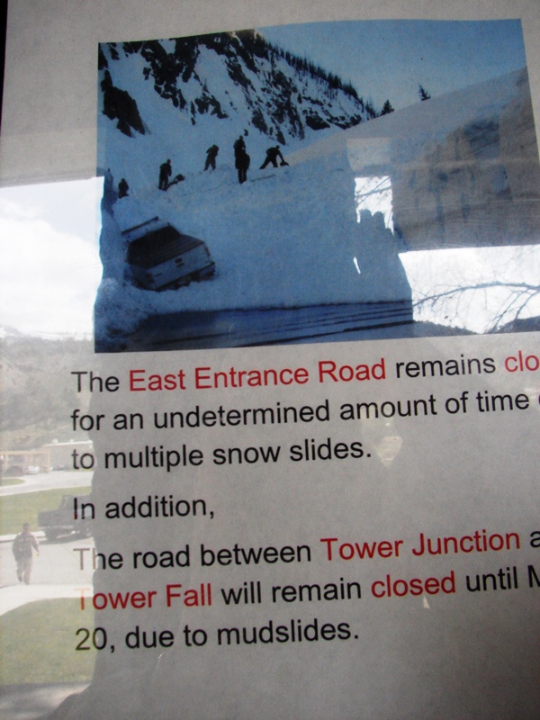 While at the Albright Visitor Center, we saw a photo of the snow slide at Sylvan Pass that had closed Yellowstone’s East Entrance. It had been actually four significant slides—”one resulting in a debris field 70 yards wide and 20-30 feet deep across the road.” Wow . . . it’s one thing to have snow in mid-May, but major avalanches? Wow.
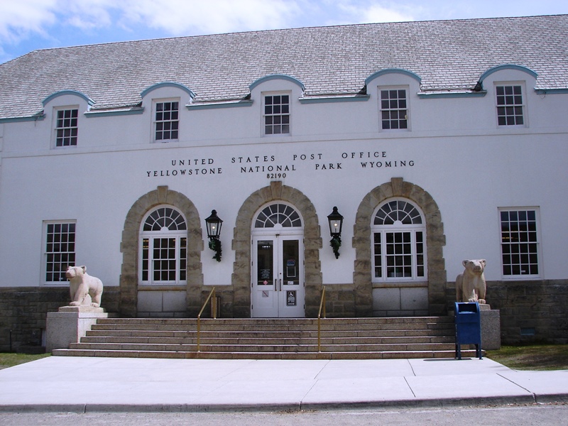
Mammoth Hot Springs’ post office has understated classical architecture with a low hipped roof, rounded dormers, and two giant grizzlies flanking the front steps.
Mammoth’s historic district is a pretty area with well-maintained buildings, tree-lined streets, neatly mowed lawns . . . and elk. We saw elk grazing everywhere. Signs warned about NOT approaching the wildlife.
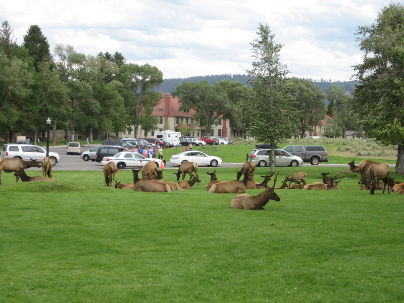
Elk at Mammoth Hot Springs. (Photo: Jenny Patterson)
A good place to stay
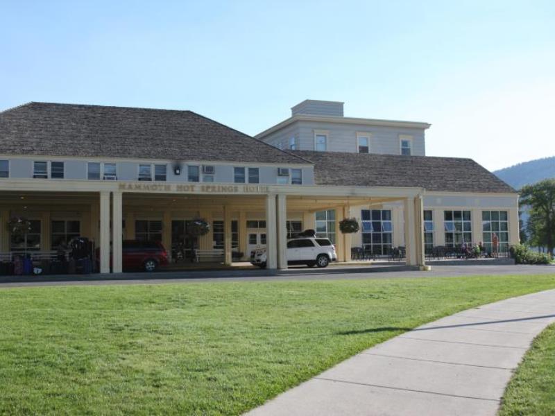
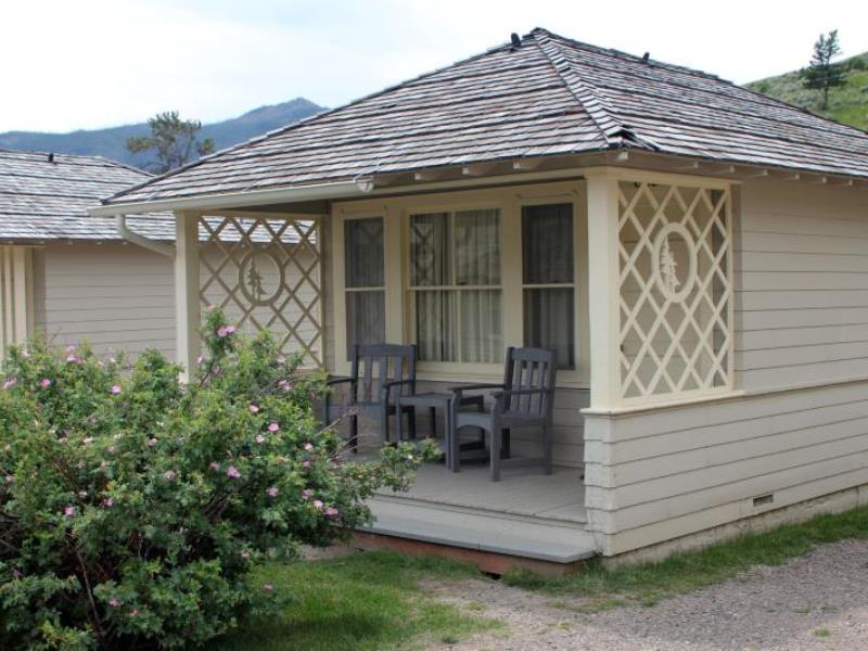
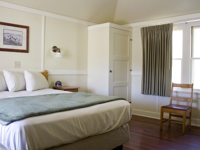
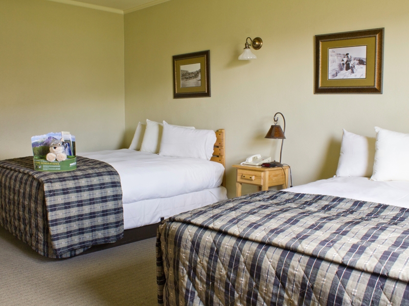
Mammoth Hot Springs Hotel and Cabins are located right in the park near Yellowstone’s North Entrance and geothermal features. Talk about convenience. Everything you need is right there—restaurants, gift shops, post office—making it a perfect home base for exploring the area around the upper Grand Loop.
The historic district is directly adjacent to the Mammoth Hot Springs geothermal terraces and pools.
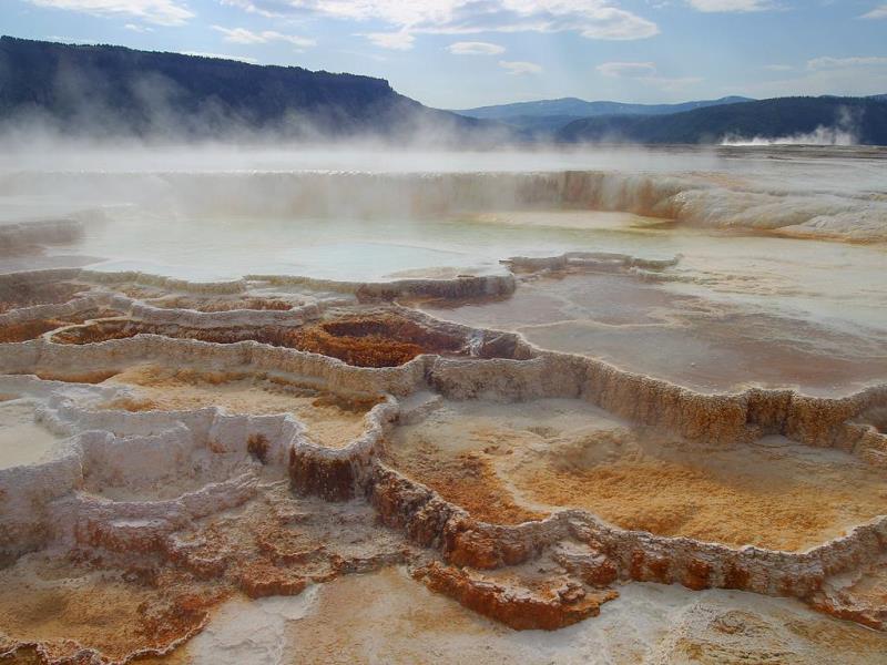
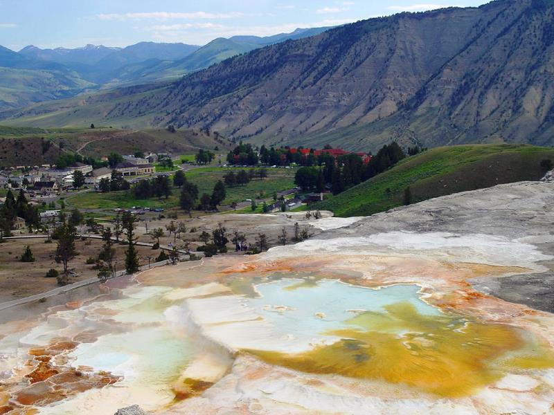
The terraces and pools
Mammoth Hot Springs has been a hotbed of geothermal activity for several thousand years. Hot water rising through fissures in the rock flows out and cools, depositing minerals on the earth’s surface in the form of travertine steps or terraces.
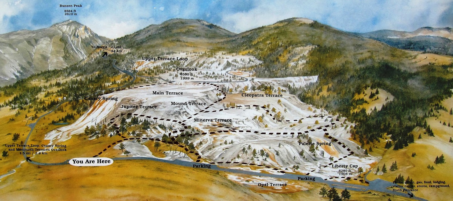
The Mammoth Hot Springs Hotel and all of Fort Yellowstone were built on an ancient terrace formation known as Hotel Terrace.
Down the road are the Lower and Upper Terraces that make Mammoth Hot Springs a popular tourist destination.
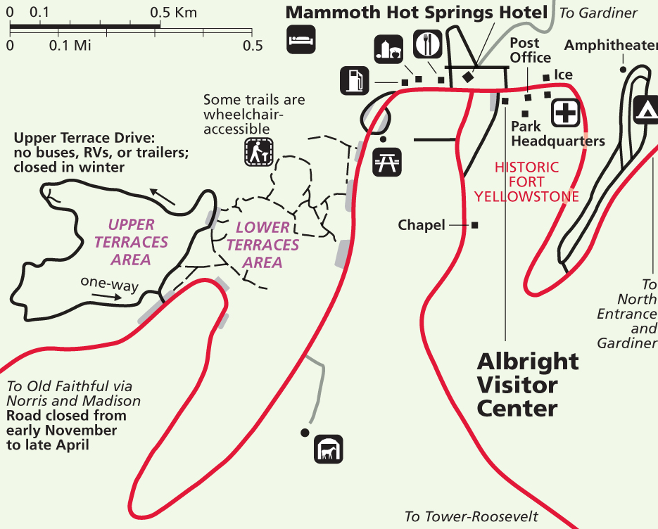
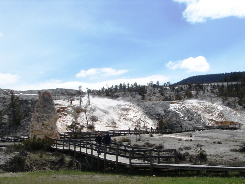
There is plenty of parking at the Lower Terrace. Boardwalks provide walking trails that are easy to follow with informational signage explaining the thermal features you are seeing.
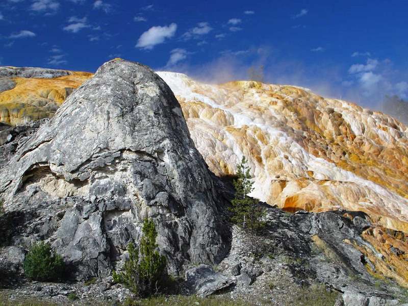
Liberty Cap, an extinct hot spring cone and familiar tourist attraction, stands 37 feet tall in a flat thermal area at the base of the Lower Terrace. The cone formed when a steady flow of hot water, emerging from a single source, deposited dense layers of travertine. It continued to grow as long as there was a source of water. It’s not known why or when Liberty Cap became extinct.
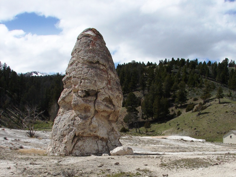
Liberty Cap, the now-extinct hot spring cone.
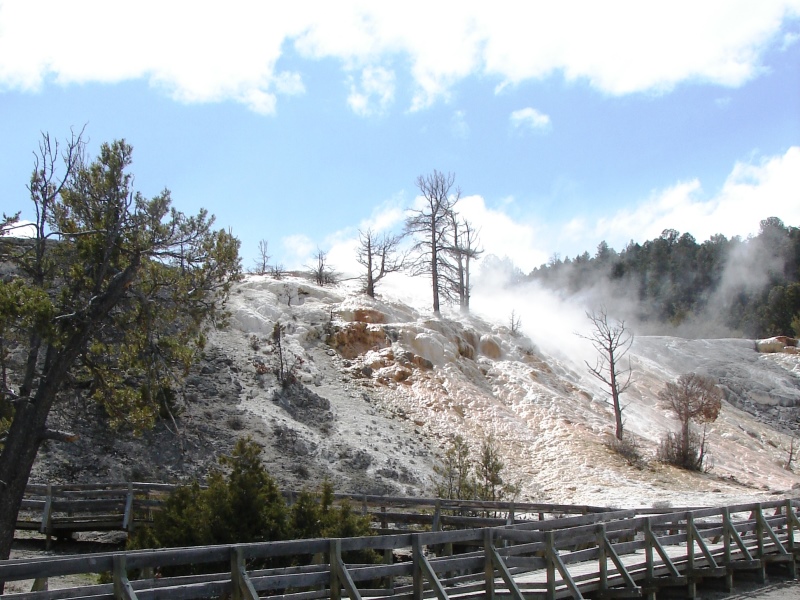
Steam rising from the Lower Terrace.
Beyond Liberty Cap, steam rising from the Lower Terrace is evidence of thermal activity.
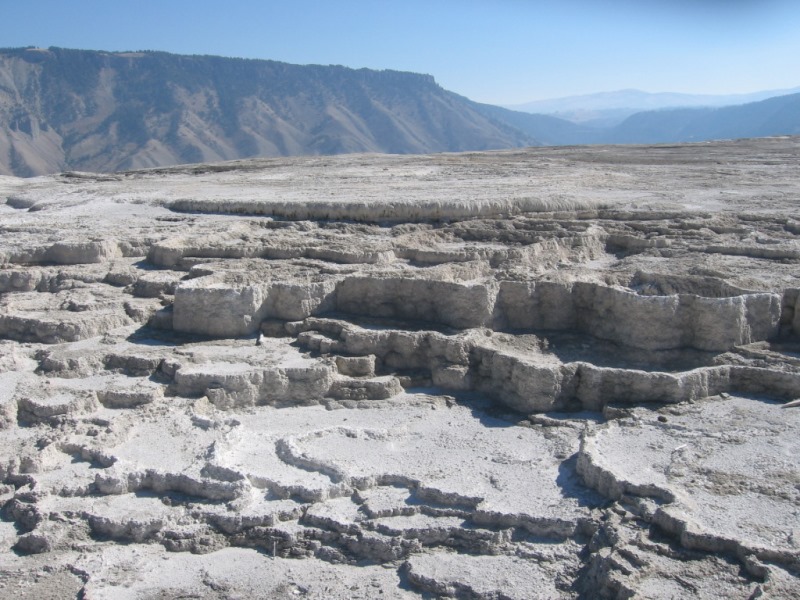
The Lower Terrace appears bathed in white calcium carbonate.
The Main Terrace – Active
That same Main Terrace – Inactive
We missed it, but it’s worth seeing
We didn’t have time to view all of the terraces at Mammoth Hot Springs. You need to allow a minimum of two hours to walk trails through the Lower Terrace. It’s a lot of walking, and there are steps to climb up-and-down as you go from one terrace to the next. Trails go up up up the mountain, and each level is a little different. Elevation changes approximately 300 feet, so there are some steep grades. You’re advised to stay on the trail at all times. What you have all around is hydrothermal activity with unstable ground and scalding water—you don’t want to step into it. No pets. No smoking. No litter. Dangerous levels of hydrogen sulfide and carbon dioxide have been measured in some thermal areas. If you feel sick, leave the location immediately.You can drive through the Upper Terrace via a narrow, one-way, 1.5-mile Upper Terrace Loop—stay in your car or park along the way to get out and view the thermal features there.
View from the terraces with the Mammoth Springs Hotel in the distance. (Photo: Life at the Blue Rock Ranch)
We had only scratched the surface of Yellowstone when we had to leave. It was late in the afternoon, and we were at least three hours away from our hotel in Cody. Not a bad time frame, but the return trip included maneuvering through hairpin mountain turns on an unlit Chief Joseph Scenic Byway, something we did not want to do in the dark. We had no choice but the turn around and retrace our steps back.
We missed it, but it’s worth seeing
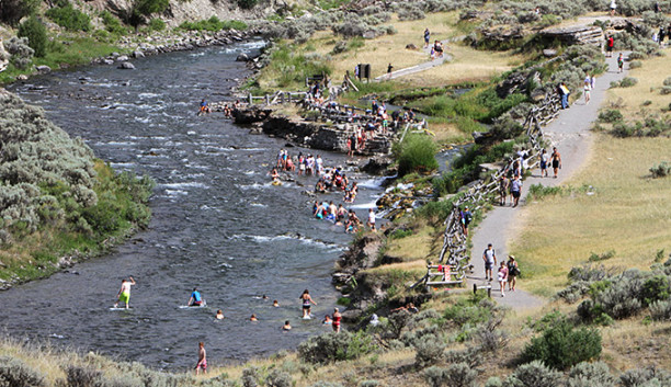
Boiling River is located just outside the North Entrance of Yellowstone where a large hot spring enters the Gardner River. The hot and cool waters mix into a temperature comfortable enough to bathe in, creating a natural hot tub. Soaking is allowed near the thermal outflow, but not in the feature itself, and only during daylight hours . . . at your own risk.
Crossing the Gardner River . . . again . . . with Bunsen Peak (elevation 8,564 feet) in full view.
Heading east on Grand Loop Road towards Highway 212 and the Northeast Entrance, I was viewing the other side of the road and seeing sights I had somehow missed the first time around.
Blacktail Plateau Drive
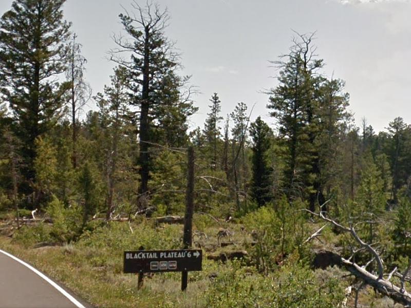
Blacktail Plateau Drive is easy to miss. Traveling northeast on Grand Loop Road, the turn-off is past Blacktail Pond . . . just before you reach Phantom Lake.
We missed it, but it’s worth seeing
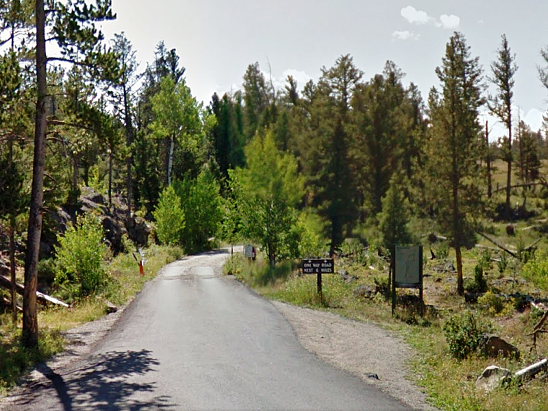
Blacktail Plateau Drive is a 6-mile one-way dirt road that takes you into the back woods and meadows of Blacktail Deer Plateau. It’s slow-going with many curves and bends, but, if you have the time, it’s a good way to get off the beaten track, see wildlife, and enjoy the pristine beauty of Yellowstone.
The exit for Blacktail Plateau Drive, where it meets back up with the Grand Loop Road.
Winding its way through the park, the Yellowstone River is as wild as the wildlife.
The Lamar River tumbles through a short and narrow canyon that is noted for having rocks the size of cars.
In 1996, wolves were brought to Yellowstone from British Columbia, Canada. The wolf restoration was called the greatest conservation success story in America’s history. The Lamar Canyon wolf pack continues to be a big attraction and can be spotted, along with other packs, in the Lamar and Soda Butte Valleys. Though we did stop, we didn’t see any wolf.
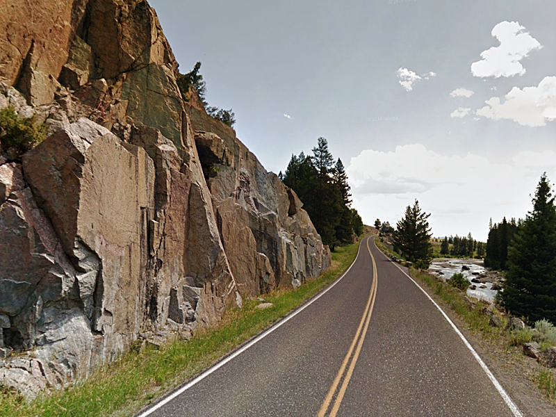
Grand Loop Road, flanked by tall rock and the Lamar River.
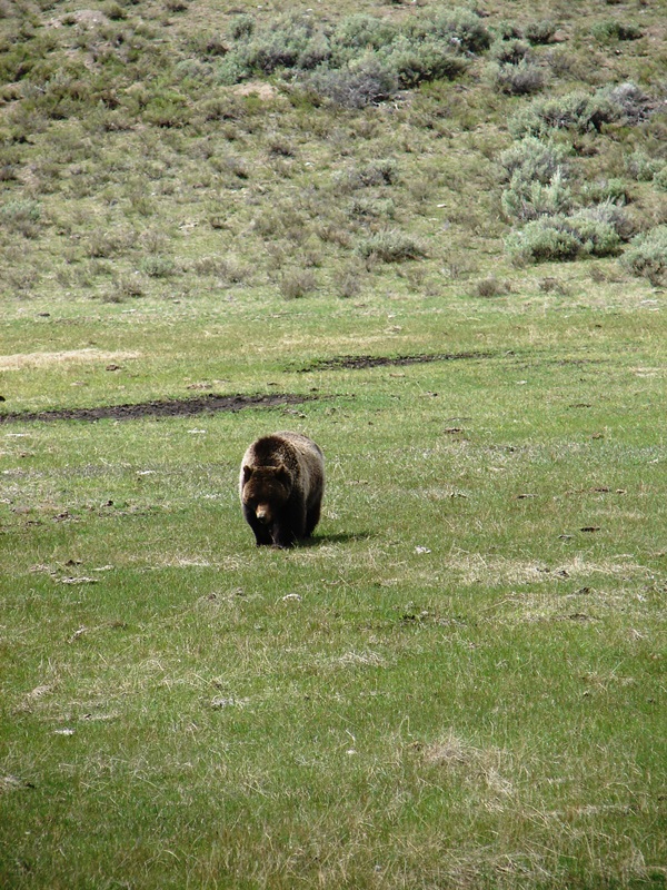
Then, we saw it . . .
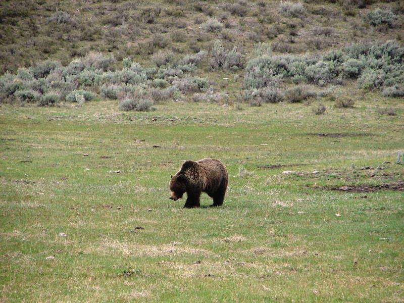
Our first bear sighting.
Here he comes.
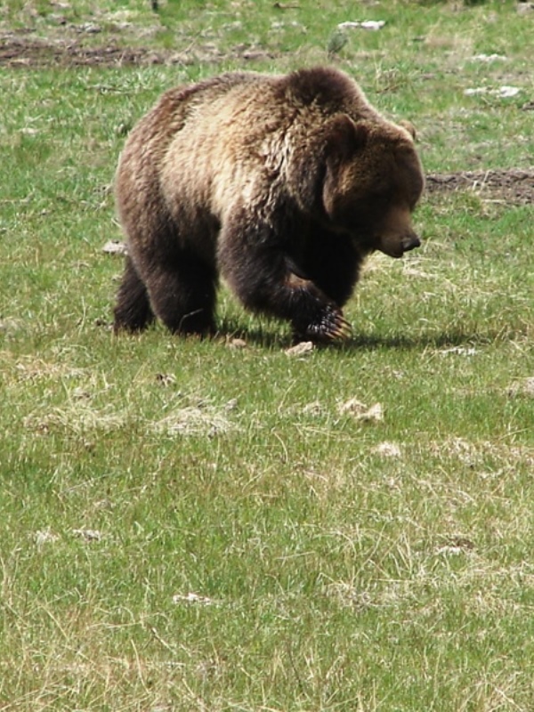
Getting closer.
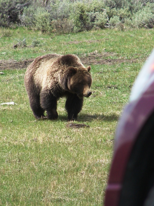
A little too close for comfort.
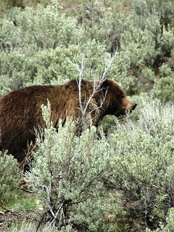
There he goes.
It didn’t matter if we had the time or not . . . it didn’t matter if we were breaking the rules. Seeing that bear was enough to make us stop dead in the middle of the road. I got out of the car to take photos along with a slew of other people caught in the mild bear jam. Using my zoom lens for close-ups, I was determined to get as many photos as possible so I would have an indisputable record that I had seen a bear up close and personal in the wild. I don’t know why it was so important to me—it just was. The bear was huge . . . and looked super soft and cuddly. Foraging for food, he seemed oblivious to what was going on around him and went about his business without paying us any special attention.
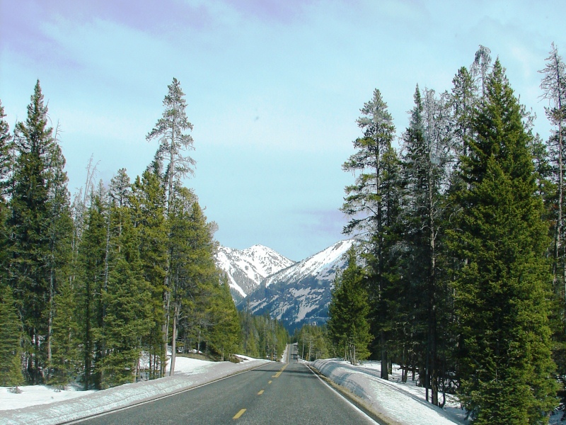
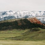
At Soda Butte Canyon, snow-capped Abiathar Peak (elevation 10,928 feet) and Amphitheater Mountain (elevation (8,358 feet) in the Absaroka Range come into view.
The road follows Soda Butte Creek along Lamar Valley.
Snow all around as we head for Yellowstone’s Northeast Entrance.
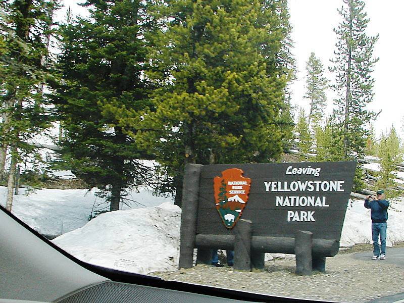
Leaving Yellowstone National Park through the Northeast Entrance.
Montana
We drove on Beartooth Highway (US 212) through the Gallatin National Forest in Montana for a short while. It was the same snowy route we took coming in.
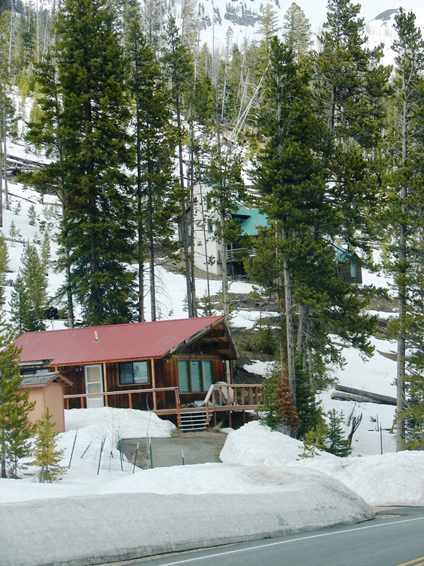
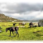
Living in the mountains of Montana just outside Yellowstone.
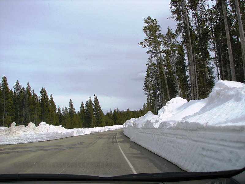
View of Beartooth Highway (US 212) from the front window of our car.
We missed it, but it’s worth seeing
Beartooth Highway is a section of US 212 between Cooke City and Red Lodge in Montana. The highway passes through portions of Custer National Forest, Shoshone National Forest, and the Absaroka-Beartooth Wilderness. It follows a series of steep zigzags and switchbacks along the Montana-Wyoming border to Beartooth Pass (elevation 10,947 feet) offering daring landscapes and spectacular views. Charles Kuralt called it “the most beautiful drive in America.” Driving time for the 69-mile trip is at least two hours. Since we wanted to make it back to our hotel in Cody before dark, we could only follow the highway through to the junction where it meets the Chief Joseph Scenic Byway.
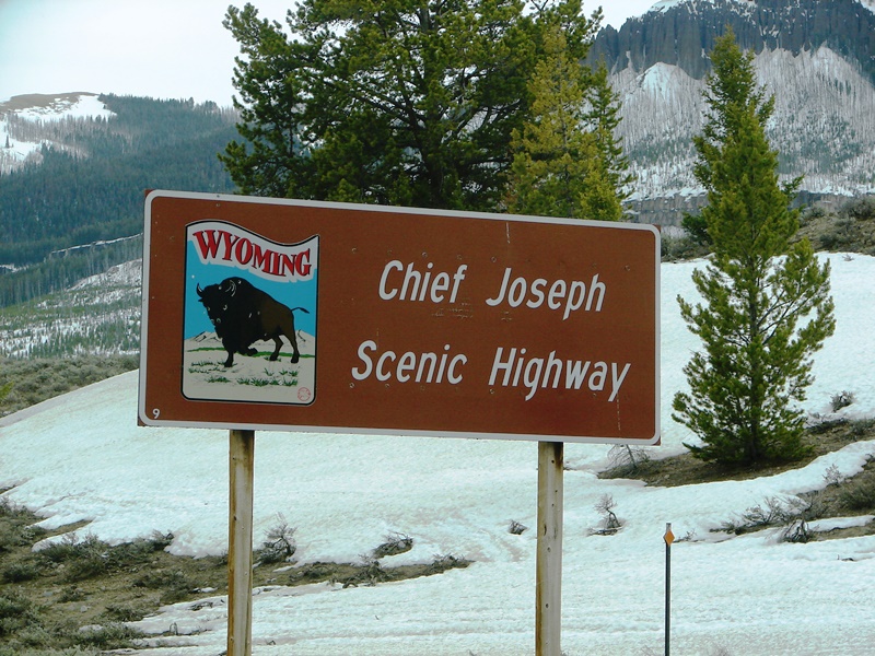
Sign just inside the junction of US 212 and WY 296 welcomes us back to the beautiful byway.
Barren trees look like a 5 o’clock shadow on Sugarloaf Mountain (elevation 8,782 feet), near Camp Creek.
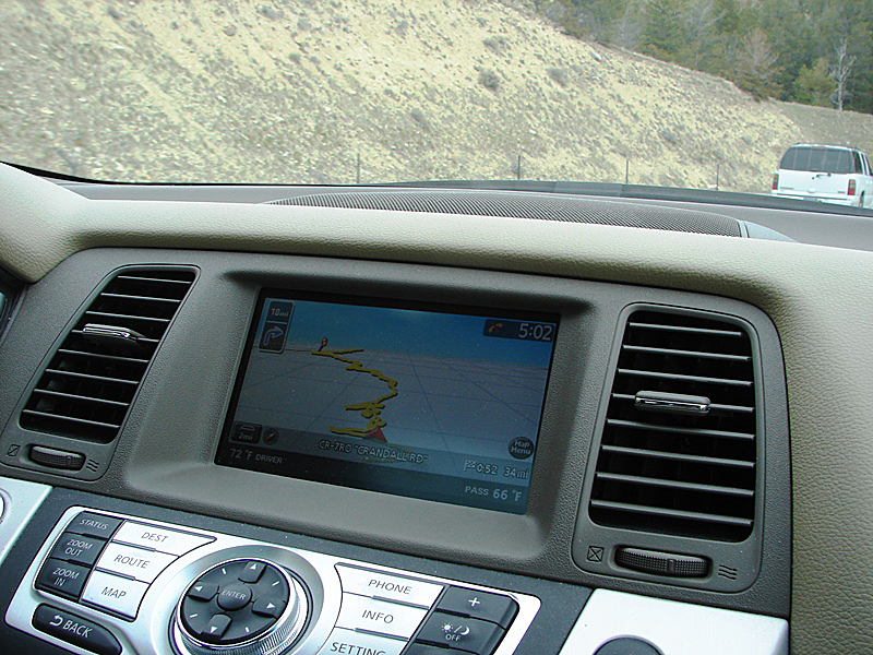
The byway switchbacks are a scrambled mess on our GPS screen.
Somewhere in the Sunlight Basin area, darkness suddenly descended upon the valley.
We returned to Cody, content and ready to move on.
Though we had hoped for two full days in Yellowstone, it was apparent after our short visit, even two days would not have been enough.
We abandoned plans to return to Yellowstone in the morning. There was no point. Even if we got up at the crack of dawn, there would not be enough time for us to drive all the way to the Northeast Entrance again . . . to Mammoth Hot Springs (on the only open road) . . . and beyond—how far could we go?—before having to turn around so we could get back to Cody before dark.
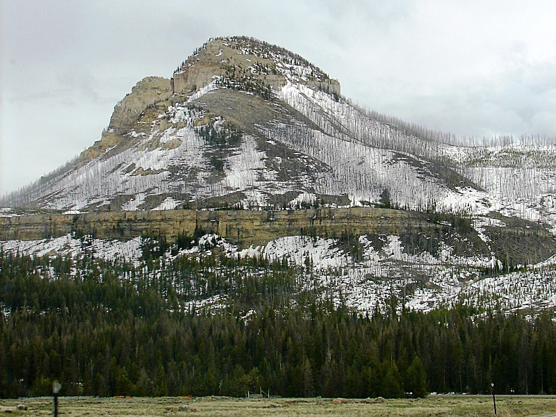
At Sheridan and 14th in Cody . . . Heart Mountain is shrouded in cloud.
Instead, we started out the next day, bright and early, on our trek east. Little did we know we were heading right into more snow and a treacherous storm on the slippery slopes and switchbacks of the Big Horn Mountains.
Copyright © 2011 Patricia Petro/Tom Schmidt. All rights reserved.
Maps and some photos were found online. Links to the source sites have been provided. I encourage you to visit these sites to read what others have to say.
Gary Benson | Empty Byways | Life at the Blue Rock Ranch | John Muir, The Yellowstone National Park | Inside NanaBread’s Head | National Park Service | Jim Peaco | Jon Sullivan | Trip Advisor | Yellowstone National Park Lodges
Share Your Thoughts